24 Hours in Zion National Park
My jaw dropped as I drove through Zion's gates. It was dark, but the lush, green foliage juxtaposed against the mountainous sheets of rich, red rock glowing in the moonlight gave me chills - this is a special place.
After touchdown in Salt Lake City, I picked up my rental (courtesy of the car sharing app, Turo). My car rental requirements included 4WD or AWD and back seats that could fold all the way down because a little car camping was in my future.
After a quick stop at Walmart to pick up the goods I couldn't carry on the plane (like pepper spray (safety first!), 2 jugs of water, and propane for my camp stove), I was off.

Hey, friends! I love recommending the gear that I'm stoked about and use on the regular. As such, this post contains some affiliate links and I'll receive commission upon any purchases made through those links.
Table of Contents
Where To Camp
Four and a half hours later, I arrived to the outskirts of Zion National Park at a late (or early depending on how you see it) 2 a.m. Utah has a ton of federal public land (called BLM Land for the Bureau of Land Management) that's a camping free-for-all, and because seemingly everything I do is last minute, most campgrounds were totally booked up, so this totally saved my life. Campers must sleep at least 0.5 miles away from any main road, so a series of short dirt roads dart off into public land here and there where you'll probably find fellow nomads setting up camp for the night.
Check out a list of all BLM registered campgrounds here.
I pulled into a spot in Hurricane Cliffs' BLM campground for my first night, about 40 minutes from Zion's entrance, and passed out for a couple hours before my sunrise hike.
The Park
Cozied up in my cocoon sleeping bag, (new(ish) from the Wonderland Gear Exchange in Seattle - my new fave store), my alarm goes off all too soon. The moonlight blazing into my back window, my eyes heavy after a short two hours of sleep. Time to drive to the National Park that's been on my mind for years: Zion.
About 40 minutes later, massive dark shadows surround my Sportage as I cruise along Highway 9's winding road -- the starry sky was just starting to catch the sun's glow over the horizon. Still dark, I can slightly make out the details of greenery on the canyon floors where rivers cut through red rock and make their way down into the vast unknown. I pass through a tunnel where ever so often a hollowed out arch opens up to a mind boggling ravine beyond, again barely visible in the dark desert night. Just on the other side of the 1.1-mile tunnel lies my first stop -- the Canyon Overlook Trailhead.
Pro Tip: Annual Summer Road Closures - IMPORTANT INFO
The Zion Canyon Scenic Drive closes to private vehicles in the summer months (March - November) to avoid over-congestion, so visitors must park their car at the Visitor's Center or the museum in the park, or in the town of Springdale where they'll then catch a shuttle to take them up the canyon. I know, I know, I was pretty upset when I learned this detail, but it actually worked out wayyyy better than I could've hoped.
The shuttles run every couple of minutes and drop you at every destination up and down the Scenic Drive with interesting history playing over the loud speaker to give you a little background on the ancient formations and cultural history of this place of refuge. Think about it: no parking issues, no traffic, no worries, plus a little education bonus.
But what if you want to catch sunrise or sunset? That's the tricky part. Bikes are allowed up the Drive, so if you have one, put it to good use. Otherwise, you can walk, but absolutely no cars are allowed unless you've reserved a campsite in the park itself. The good news is, there are hikes along Highway 9 (where cars are allowed), that are also crazy beautiful, so I hit up one of those for sunrise instead!
Canyon Overlook Trail
Length: 1 mile round trip
Elevation: 100 feet
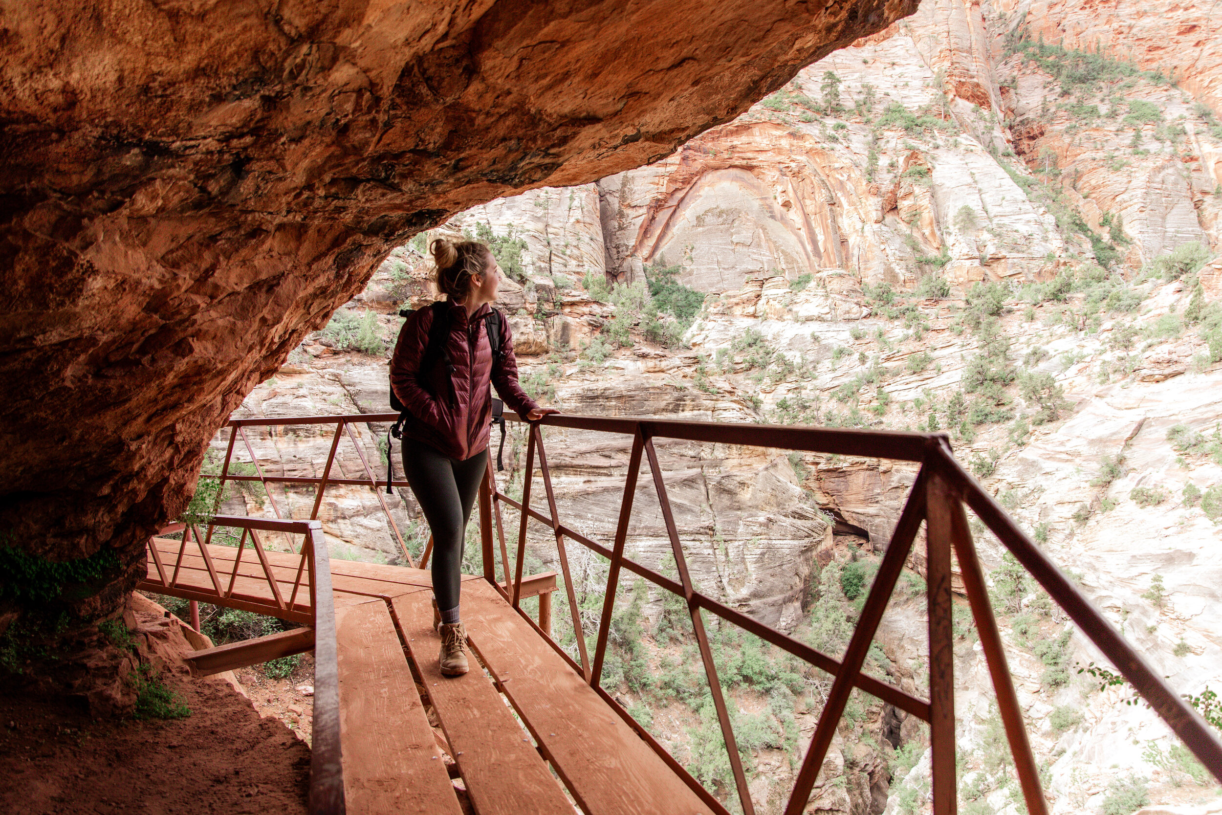
Parked, I whip out my toothbrush and give my teeth a quick cleaning, change my clothes, and set off for sunrise. The trail is just 1 mile roundtrip -- an easy hike for all skill levels and ideal for carrying heavy camera gear. Past red rock faces, cacti, and scraggy trees, a small, rickety metal and wood bridge appears, connecting the trail to a cave around the corner a couple hundred feet above the ground -- sketch, but rad. The trail continues, up over more rock, rounding dry streams, damp from a recent rain.
"Hello?!" I hear, making me jump what felt like five feet into the air. "Are you on the trail?" asked a man with no face or name. He rounds the corner, navigating one of the streams the flash floods create.
"You freaked me out!" I say with a laugh. "Yeah, I'm on it, come on up this way!"
The trails in Zion, I came to find out, look much like the landscape - worn stretches of rock and sand. It's easy to meander off-route letting a dry stream lead the way.
I continue on, when a final incline opens up to a view so expansive, I had to blink to make sure it was real. I was the first one there, alone with what seemed like all of Zion in front of me -- it was magical to say the least. This is where my camp stove and instant coffee would've been prime, if only I had remembered to grab it out of the car.

My "friend" arrived not too much later, both whipping out our camera gear at the same time and admiring each other's prized possessions -- it's a thing. With an obvious mutual love for photography, it was easy to start a conversation we were both amped about. I took pictures of him, he took pictures of me, we both shot some film, talked about life, and yup, became Instagram buddies (@ukrainesky) and have every intention to meet up again in the near future. Freaking rad how that happens -- especially when traveling alone.
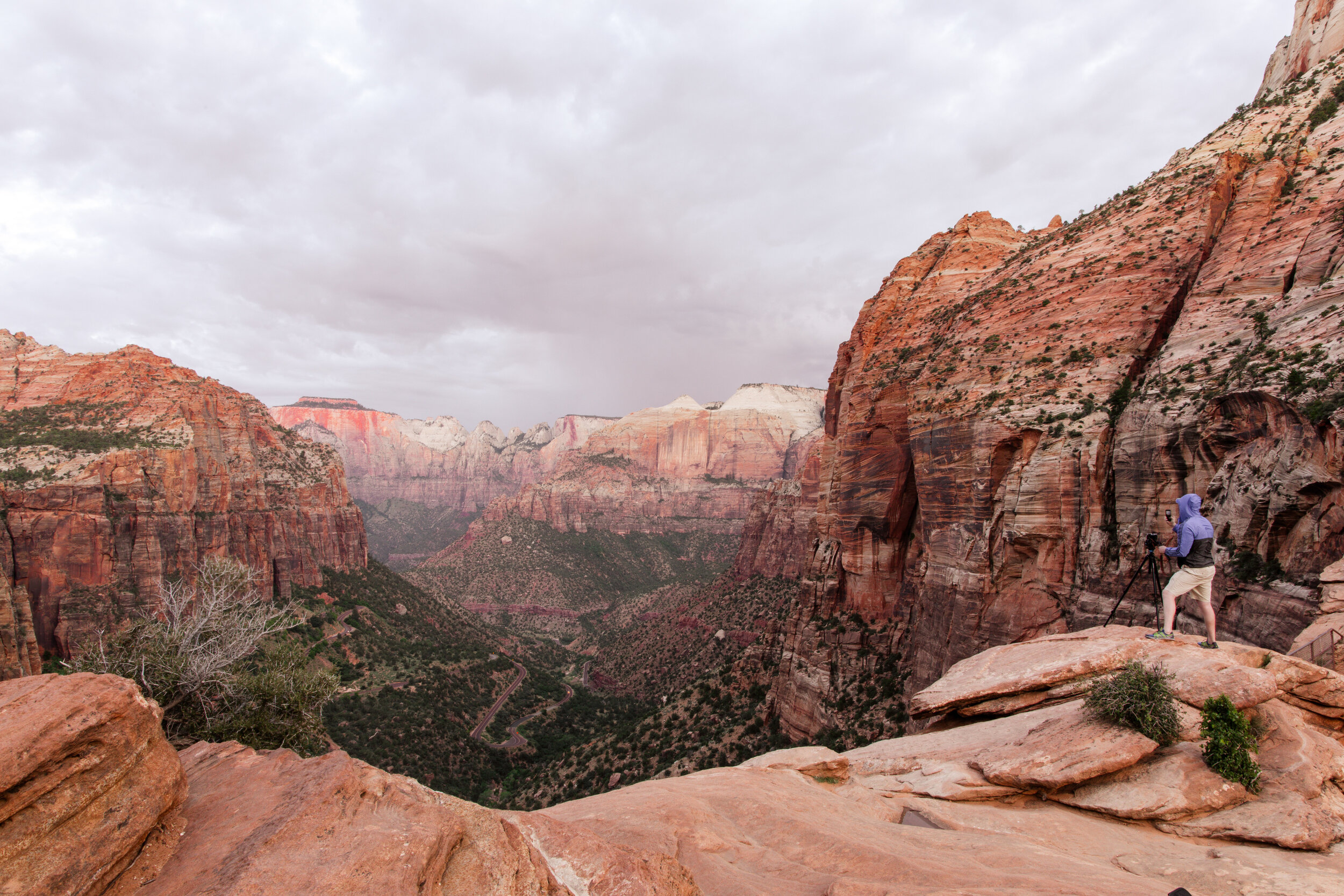
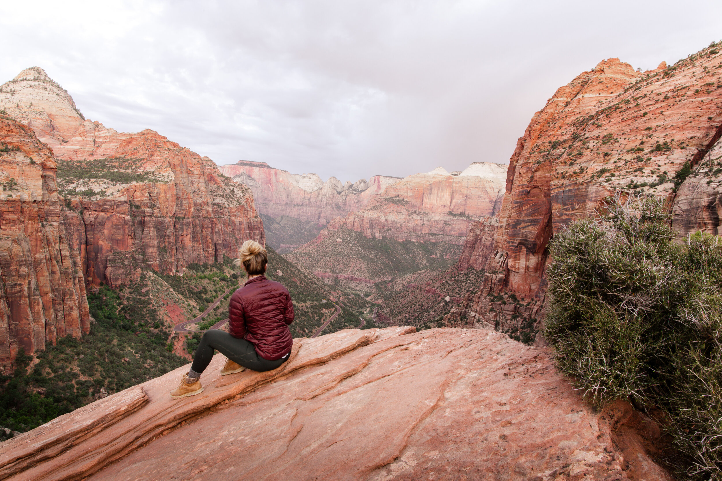
The sun eventually rose behind us, illuminating the cliffs in the distance one by one (when the clouds weren't rudely blocking its rays). We were the only ones there for a solid hour and no other photographers ever showed up - a few tourists, sure, but no other photographers. It was unbelievable.
But, it was time to head off to my next destination -- Angel's Landing -- before the heat of the sun set in. So, we packed up, hiked down together, and exchanged info to keep in touch. Zion was off to a fantastic start.

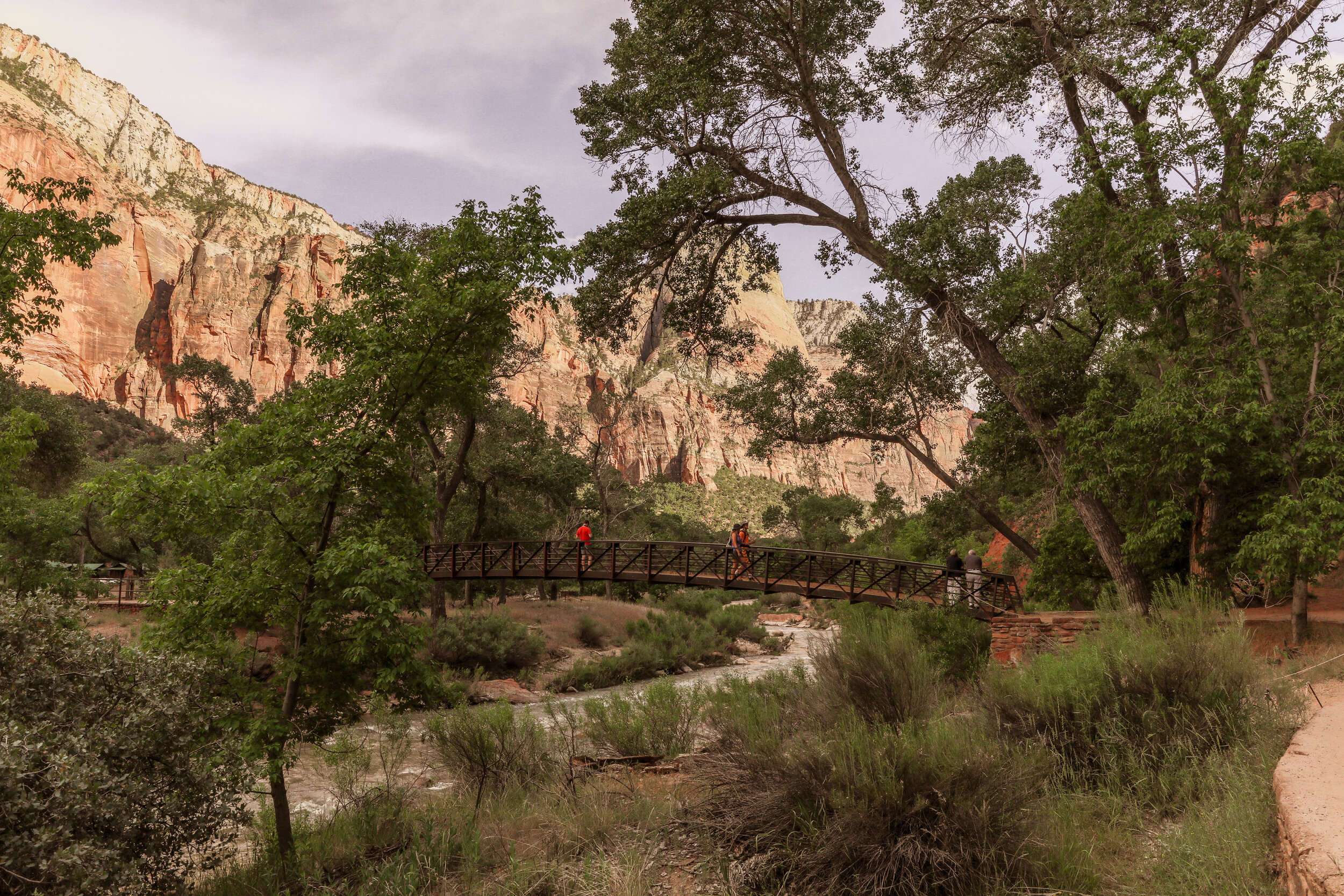
Angel's Landing (The Grotto)
Length: 5.4 miles round trip
Permits: Required
Elevation: 1500 feet
Angel's Landing is on the Scenic Drive, which means I had to find a parking spot and hop on that shuttle. I was there early enough to find one at the museum -- the closest shuttle stop to the drive. An earful of interesting park history later and I disembarked at Stop #6 with a somewhat scary warning from the bus driver. "Be careful up there, folks. It's super dangerous, and if it rains, get out of there ASAP." Cool. I could die today. No big deal.
LOTTERY INFORMATION
**UPDATE: Permits are now required to hike Angel’s Landing (The Grotto).
You have a couple of options:
1) Enter the Seasonal Lottery to try to secure a permit before your trip. Each permit season is three months long, and the lottery opens two months prior to the first month in a lottery season. You have 20 days to enter–permits are released on the 25th of the lottery entrance month. It costs $6 to apply and permits cover up to 6 people.
2) If you’re more of a last-minute planner like me, you can apply to the Day-Before Lottery which, opens every day at 12:01 a.m. and closes at 3 p.m. Mountain Time (MT). It costs $6 to apply and the permit covers up to 6 people.
Pro Tip: If you're there in the summer, do this hike early! The heat is sweltering come midday and I can't imagine hiking Angel's Landing in those conditions. You'll avoid the crowds too!

Views.For.Days.
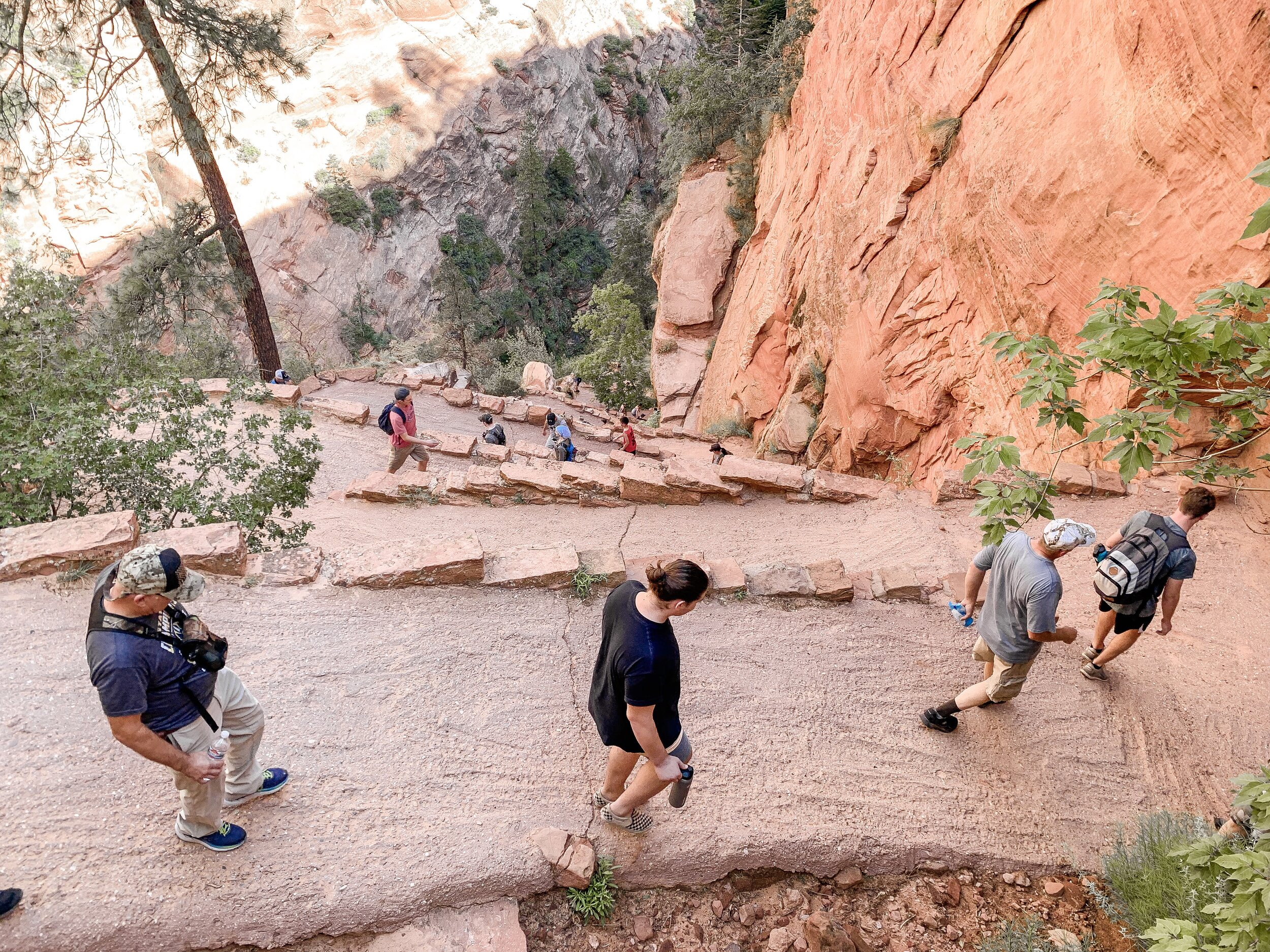
I took advantage of this solo hike by stopping at practically every scenic viewpoint. The trail changes sooo much, winding through various landscapes, from riverbed views to steep switchbacks and between canyon walls; there was always something new to snap a photo of. The switchbacks are no joke, with a total of about 25. The incline was tough, not gonna lie, but beautiful every step of the way.

View from Scout's Landing - Angel's Landing trailhead in the distance
Once at Scout's Landing (the plateau just before the Angel's Landing trailhead), I refueled with a bit of beef jerky and water, eavesdropping on those around me. I'd say about 70% didn't feel the need to ascend the extra mile to Angel's Landing, but not me - you gotta risk it to get the biscuit.
The final stretch to the top was definitely sketch -- like very sketch. The park rangers were not joking and the onlookers from Scout's Landing were right to think twice. It's one, steep, skinny trail over slick sandstone with a ~5,000-foot drop a step away in each direction. Chains guide you up the trail, but here's the clincher: it's the same way there and back, so as you're climbing, hikers are trying to slide past you on their way down. What does that mean? Well, more often than not, you're scaling the side of a cliff, crouched on all fours, and selflessly offering the chain to down-hikers as you wait your turn. I was so focused on gripping on for dear life that I forgot to snap a photo, my apologies!
Pro Tip: Lend a helping hand when you can! Everyone from seasoned hikers to first-timers attempt this trail and a little extra leverage over a slippery rock could literally save someone's life.

The good news is, this is a fantastic place to meet people! Hikers from all over the world visit Zion to hike Angel's Landing. So, say hi, introduce yourself, ask where they're from, and BOOM, you're instant adventure buddies. I met a solid group of people on my way up by simply bonding over how sketchy the hike was and helping each other over challenging sections. They were super rad and down for the adventure, so we ended up spending the rest of the day together.
After what felt like a million years, we joined the party at the top of the Landing. Between the sense of accomplishment that came with completing the hike, not dying, and taking in the 360-degree views of Zion National Park, smiles were abundant. My newfound friend group plopped down on a rock and broke out the snacks -- a little chipmunk kept us company.

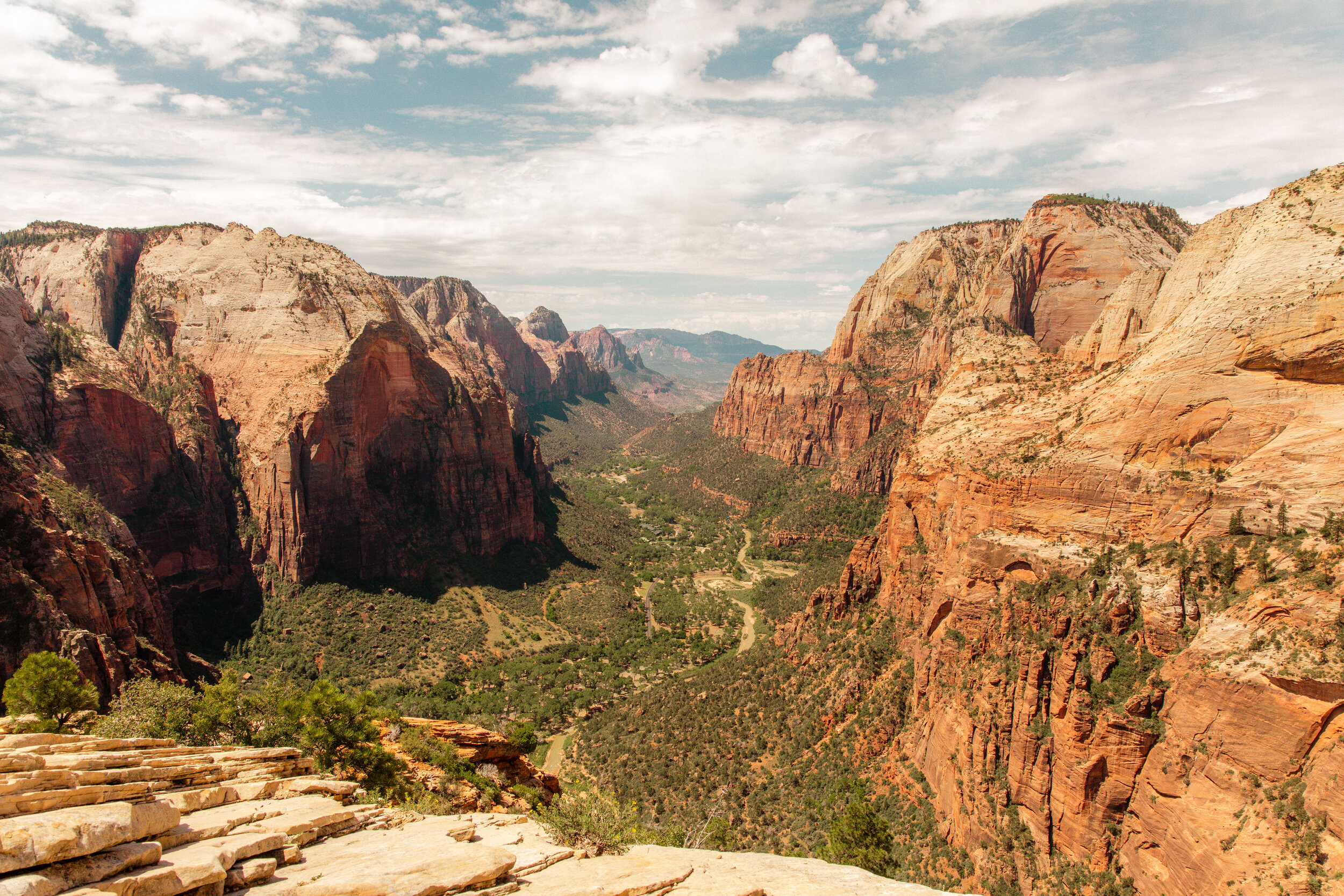
Views south from Angel’s Landing.
It was getting hotter by the minute and we were ready for a swim, so down the mountain we went. Jake (second from the right in the photo above), actually lives just outside of Zion National Park and offered to take us to a local swimming spot!

We spent the hottest part of the day cliff jumping, swimming, and enjoying a few 5% mango hefeweizen beers (per the alcohol law, yay Utah!), chilled by the river itself.
Half of our crew had to head home for the day and pack up for their flight -- and then there were three. We had an entire afternoon to fill and the park at our fingertips -- where to go next?
A quick bite to eat, a few more beers in town at the Zion Brewery, and a quick thunderstorm later, and we ventured back into the park for our next hike: The Emerald Pools.
Lower Emerald Pools
Length: 1.2 miles round trip
Elevation: Roughly 70 feet
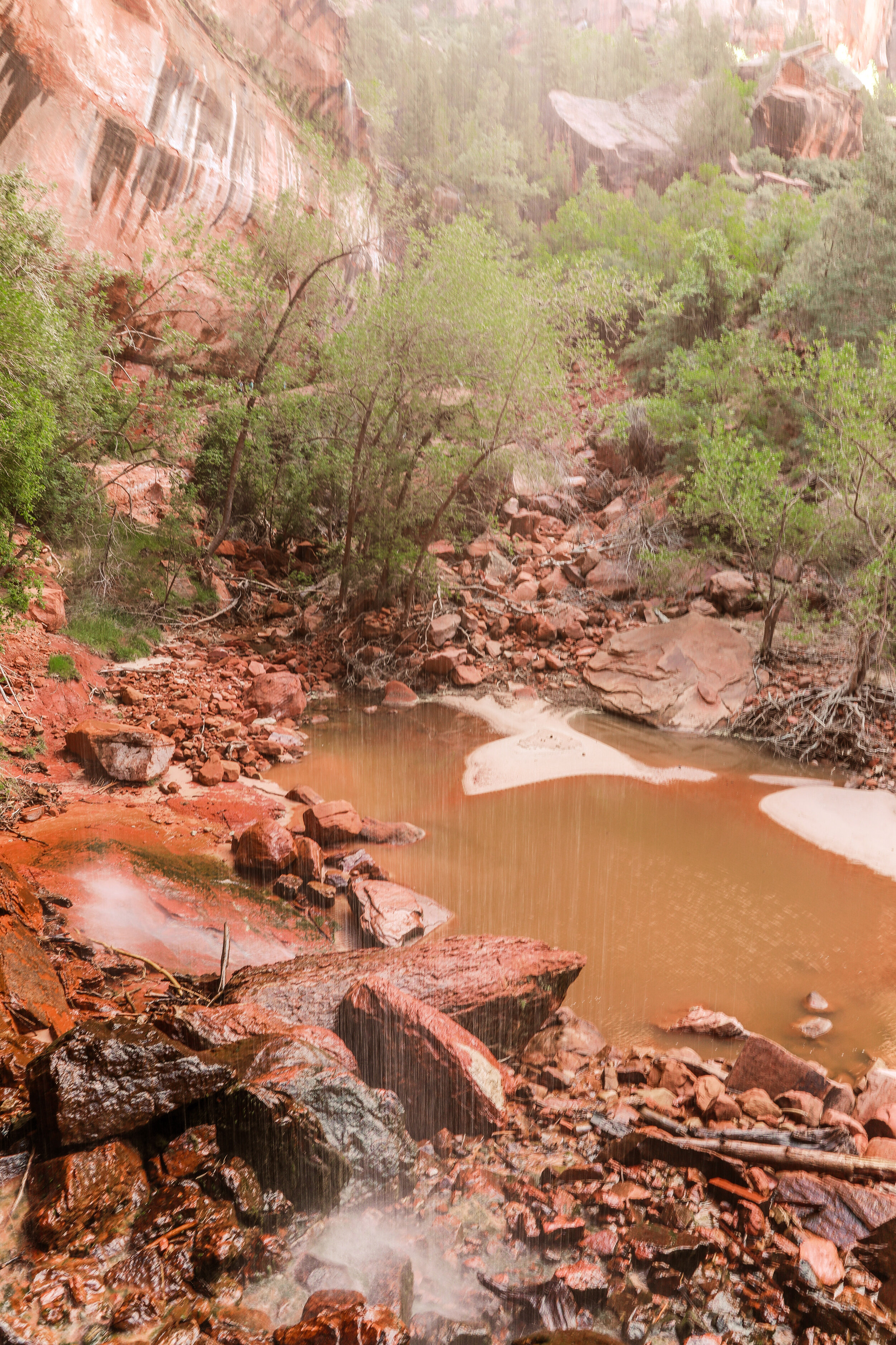
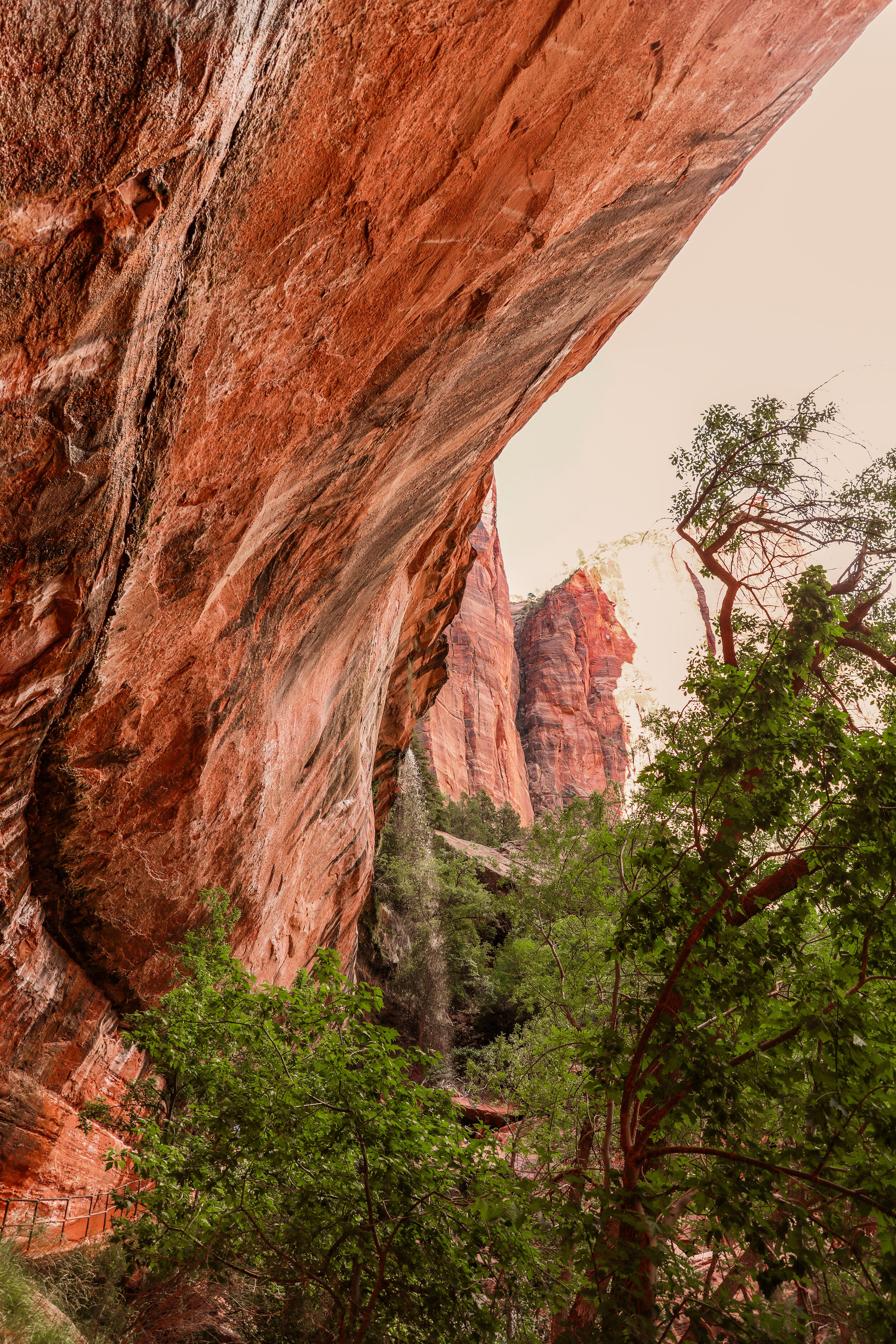
The Lower Emerald Pools (one of three on this trail) trail is a walk in the park... literally ;) Because the elevation gain is practically non-existent, this is a great choice if you only have time for one hike or you're with the whole family. A well-groomed trail leads you up along the river into this oasis, surrounded by red rock on all sides. Venture behind the light trickle of water, cascading down from the rocks above for a beautiful sight.
Sadly, the middle and upper pools were closed due to washout during my visit, but its about 3 miles round trip to do all three pools.
Zion Narrows
Length: 2.5 miles round trip (for the day hikers)
Elevation: Gradual upriver ascent
This epic river hike was also closed during my visit due to high waters from recent rains, but if you can catch this stunner open to the public, DO IT! Day hikers hike bottom up, and backpackers hike top down (it's a 2-day backpacker trip) on the riverbed, so wear a swimsuit and get ready to get wet. Towering canyon walls extend into the sky on each side of you as you make your way past beautiful cascading waterfalls.
Subway
Permit Required
Length: 9.5
Elevation: 1,500’
This beautiful hike requires a permit -- another downfall to last-minute trips -- and it's a lot like the Narrows, but much more strenuous. Hikers venture top-down one way, over waterfalls, scrambling over the riverbed, and admiring the canyon walls that form almost a complete tunnel in some places. A shuttle drops you off at the top and picks you up at the bottom. I didn't get to do it myself, but this and the Narrows are at the top of my list for my return trip!
That's a Wrap
The sun was on its way down and my next campsite was just outside of Bryce Canyon National Park. The highway, I was told, was absolutely stunning and should be seen in daylight, so I decided to say my goodbyes to this unique desert oasis, the friends I made along the way, and the memories I'll keep forever, pack up, and hit the road for my second destination.
Stay tuned for a blog post on Bryce Canyon National Park coming soon!