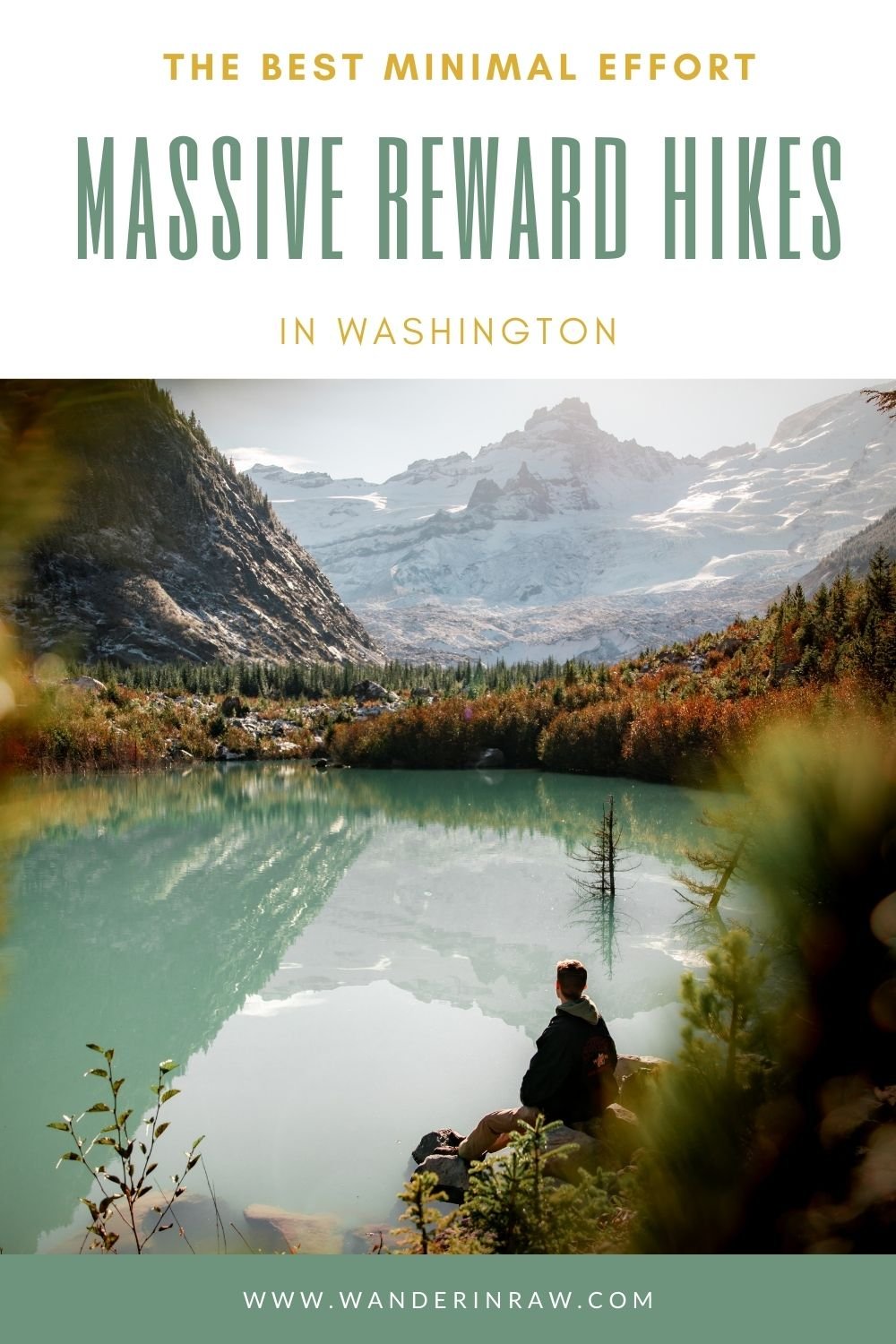
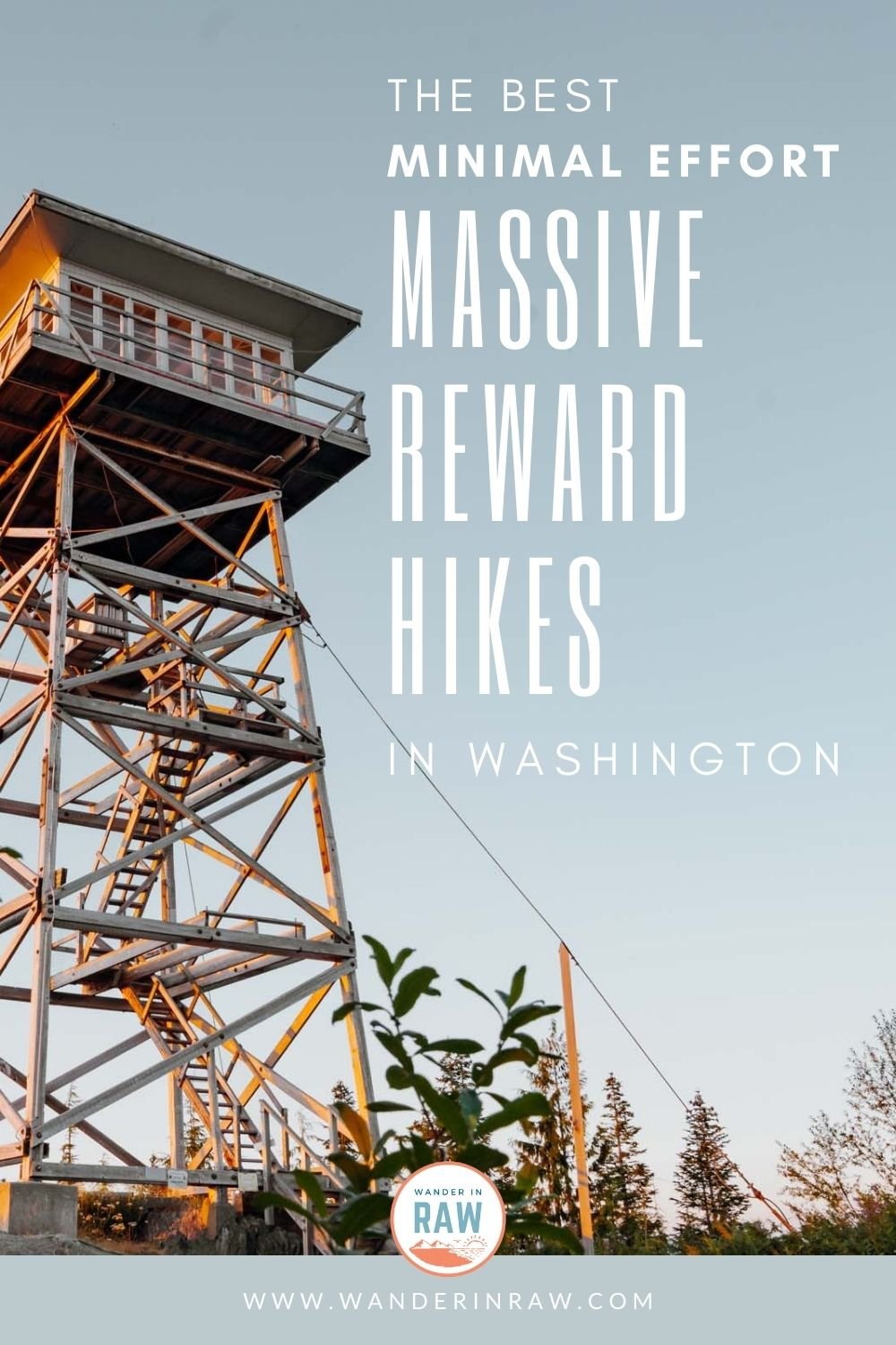
The Best Minimal Effort, Massive Reward Hikes in Washington
I’m a big fan of hikes that serve up jaw-dropping views without asking too much in return—minimal effort, maximum reward. Whether you’re new to hiking, not feelin’ a quad-burning climb, or your knees just said “nah, fam, I’m good,” these trails have your back. I’m all about making the outdoors more welcoming and accessible, and lucky for us, Washington is packed with trails that deliver the goods without the grind. Here are a few of my favorites!
Grab your ten essentials, lace up, and let’s hit the trails!
This post contains affiliate links and I'll receive commission upon any purchases made through those links at no expense to you. All opinions are always my own.
Table of Contents

Hidden Lake, Leavenworth
Enjoy 30% off an AllTrails Pro membership so you can hike off the grid and feel good about it too! Use code: Eva30 *Discount applies only when redeemed via a web browser.*
Hidden Lake Trail
Distance: 1.9 miles RT
Elevation: 219’
Location: Lake Wenatchee
Native Land: Yakama
Pass: National Forest Pass
Lake Wenatchee is poppin’ any time of the year–leave the crowds behind and hike the short 1.9-mile out-and-back trail to Hidden Lake instead. It’s a beautiful mossy tree-covered trail accessible year round!
Pro tip: Slap on some microspikes and check this trail out in the winter! The entire lake freezes over!
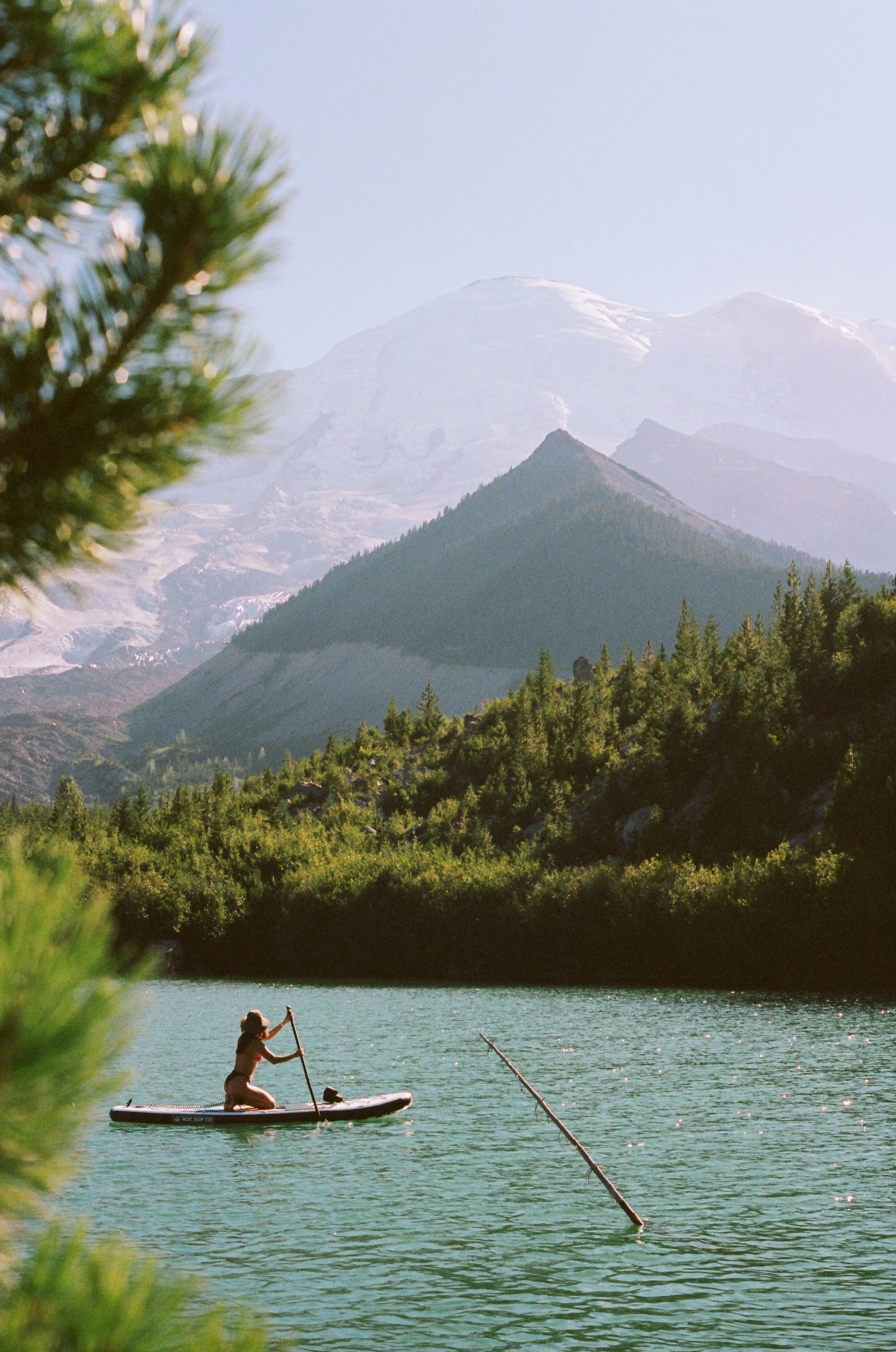
Emmons Moraine | 35mm film
Emmons Moraine
Distance: 2.4 miles RT
Elevation: 500’
Location: Mt. Rainier
Native Land: Puyallup
Pass: Mt. Rainier National Park Pass or America the Beautiful
The entire Emmons Moraine trail is 4.1 miles RT and ends at an overlook of the Emmons Glacier. Pretty dang cool! But there’s another beautiful gem at the 1.2-mile mark that’s just as impressive. After hiking through forest and across a bridge in the glacial moraine, you’ll stumble upon a stunning blue-gatorade lake.
Pro tip: Bring an inflatable stand-up paddleboard for a relaxing time on the water with an unbeatable Mt. Rainier backdrop!

Use code: Eva30
*Discount applies only when redeemed via a web browser.*
Fort Ebey Bluff Trail
Distance: 1.2 miles RT
Elevation: 59’
Location: Whidbey Island
Native Land: Tulalip, Stillaguamish
Pass: Discover Pass
This coastal trail begins at an old military fort, which is one of the State’s best, in my opinion! Take some time to walk the dark hallways for a scare. Then, continue south to meander along beautiful grass-covered bluffs overlooking the Strait of Juan de Fuca. You may even see a surfer or two down below!
Looking for more Washington surf spots? Check out my complete guide here!
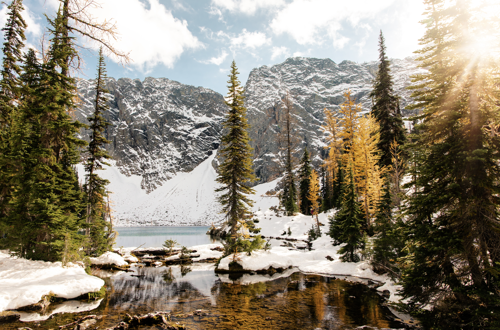
Blue Lake
Distance: 4.6 miles RT
Elevation: 921’
Location: North Cascades
Native Land: Okanagan, Methow
Pass: North Cascades National Park Pass or America the Beautiful
Hike into Washington State’s legendary North Cascades National Park to experience this beautiful, blue alpine lake with a massive granite backdrop after a stunning hike through meadows and over creeks. Keep an eye out for mountain goats! They frequent these parts.
Pro tip: Visit early-to-mid October to catch the larches in their peak season (they’re the only pines whose needles turn a golden yellow and fall to the ground during a two-week period in fall every year!).

Naches Peak Loop
Distance: 3.3 miles RT
Elevation: 636’
Location: Mount Rainier National Park
Native Land: Yakama
Pass: Mt. Rainier National Park Pass or America the Beautiful
This iconic Washington trail is popular for a reason–not only are there beautiful tarns (little alpine lakes/ponds), meadows, and mountainous views, but hiking it clockwise gets you INSANE views of the majestic Mt. Tahoma (Mount Rainier). Highly recommend.
Pro tip: Visit late spring to see the wildflowers putting on a show!
Use code: Eva30
*Discount applies only when redeemed via a web browser.*

Artist Point
Distance: Summer: 1.5 Miles RT | Winter: 4 Miles RT
Elevation: Summer: 269’ | Winter: 1,000’
Location: Mt. Baker Ski Area
Native Land: Cayuse, Umatilla, Nooksack, and Walla Walla
Pass: None
Huntoon Point is a vibe year-round. Just beyond the iconic Artist Point in the North Cascades, this mellow route offers big mountain vibes with relatively little effort, and it’s accessible in all seasons (yes, even when the snow rolls in!). The views of Mt. Baker and Mt. Shuksan are pinch-me level. I found myself saying, “what is life” with the biggest smile on my face! Highly recommend.

Tongue Mountain
Tongue Mountain
Distance: 3 miles RT
Elevation: 1,033’
Location: Packwood
Native Land: Cowlitz, Klickitat
Pass: Northwest Forest Pass
Totally off the beaten path–and sometimes tricky to get to–this short hike is well worth the drive for the sweeping 360-degree views at the top. You’ll traverse alongside Tongue Mountain until hitting a few steep switchbacks near the top. Mt. Rainier, Mt. Adams, and Mt. St. Helens are all visible from this epic viewpoint. You may even find yourself a mountain goat friend or two!
Note: Snow sticks around for a while and you may run into some downed trees over the road–I’d recommend visiting late summer for the best experience!
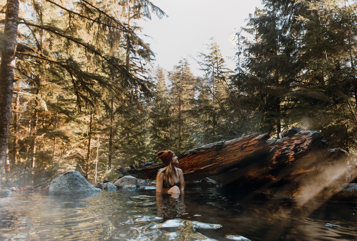
Baker Hot Springs
Baker Hot Springs
Distance: 0.6 miles RT
Elevation: 59’
Location: Mount Baker Wilderness
Native Land: Sauk Suiattle
Pass: Northwest Forest Pass
One of the few remaining public Washington hot springs, Baker Hot Springs is a short 0.6-mile RT trail in the middle of the Mt Baker Wilderness. The catch? The drive. A high clearance vehicle is required to drive the 4 miles of brutal potholes to the refuge, open seasonally. Check AllTrails for seasonal closures and updates.
Read More: Baker Hot Springs is the Off-Grid Washington Soak You’ve Been Searching for

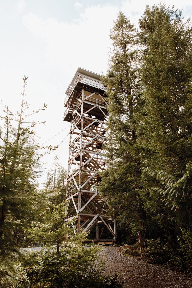
North Mountain Fire Lookout
North Mountain Fire Lookout
Distance: 2.5 miles RT
Elevation: 462’
Location: Darrington
Native Land: Skagit, Tulalip, Stillaguamish, Sauk Suiattle
Pass: National Forest Pass
This recently renovated fire lookout was a labor of love for Darrington locals, taking it upon themselves to restore this treasured mainstay. It’s now an Airbnb, and while day hikers can’t access the top floor, they’re more than welcome to climb the steps for a beautiful mountain view. The drive is lengthy (about 12 miles of forest road driving) but there are views nearly the entire way!
Use code: Eva30
*Discount applies only when redeemed via a web browser.*

Striped Peak Trail
Striped Peak Trail
Distance: 2 miles RT
Elevation: 240’
Location: Port Angeles
Native Land: Coast Salish
Pass: Discover Pass
A hidden saltwater cove with a waterfall just 1-mile in? Yes, pleaseeeee. Located in Salt Creek Recreation Area on the Olympic Peninsula (and just outside of Olympic National Park), this short jaunt is part of the larger Striped Peak Trail–you can totally hike up to the top if you’d like, but the coolest part is easily this nook at the one-mile mark. Walk the beautiful forested trail as it guides you along the Strait of Juan de Fuca’s coast. When you reach the fork, take a left to descend 30’ to the water’s edge.
Pro tip: The beach is only accessible at low tide.
Read More: Why Salt Creek Recreation Area Should be on Your Must List
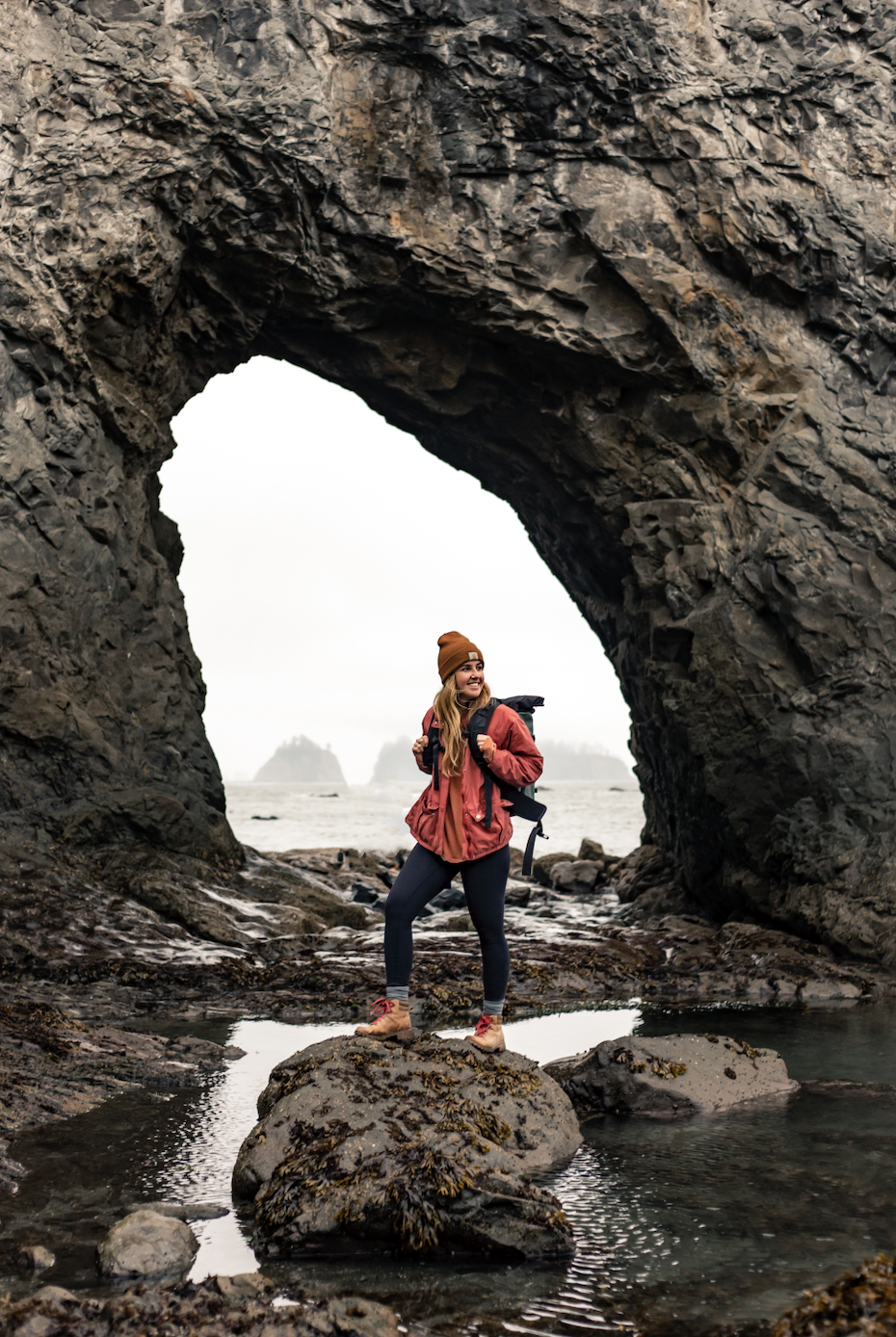
Hole in the Wall
Hole in the Wall
Distance: 3.3 miles RT
Elevation: 108’
Location: Rialto Beach
Native Land: Quileute
Pass: Olympic National Park Pass or America the Beautiful
A true PNW gem, this hike is entirely on the beach (Rialto Beach). Past the sea stacks, you’ll see a peninsula. Walk around the tip (low tide dependent) to see this iconic coastal phenomenon in real life. Don’t forget to look down! The tidepools are really something too!
Pro tip: Hole in the Wall is only accessible at low tide. Check the tide charts before proceeding, and leave with plenty of time to return home safely!
Use code: Eva30
*Discount applies only when redeemed via a web browser.*

Turtleback Mountain, Orcas Island
Turtleback Mountain: Ship Peak Loop
Distance: 2.7 miles RT
Elevation: 859’
Location: Orcas Island
Native Land: Klallam, Lummi, Samish, Tulalip
Pass: None
Hop on a Washington State ferry to Orcas Island for a beautiful loop trail that offers impressive views of the San Juan Islands and Canada. Insane. It starts up an old cell tower road before turning into a grassy trail that guides you along Turtleback Mountain’s rocky terrain. Look back for a view you can’t get anywhere else. Keep going to Ship Peak lookout for a cool view over farmland to the east before you head back down the mountain through a forest to the parking lot.
Pro tip: Hike counterclockwise for a more gradual elevation gain!
Heybrook Lookout
Heybrook Fire Lookout
Distance: 1.9 miles RT
Elevation: 879’
Location: Skykomish
Native Land: Tulalip, Skykomish
Pass: None
I do love me a classic PNW fire lookout, and this beaut has a unique feature that gives you a massive reward with a minimal effort hike. It’s tall as all get out. Climb the 89 steps to the first floor for a gorgeous Cascades view. This lookout is reservable, so top floor access isn’t allowed to the general public unless you’re spending the night.
Use code: Eva30
*Discount applies only when redeemed via a web browser.*
Leave No Trace
Always remember to leave no trace–pack out what you pack in, leave what you find, prepare for every adventure, and respect the outdoors and each other every step of the way. Learn more about how to leave no trace here.
And if you do decide to venture out on any of these adventures, drop a comment below or shoot me an email to tell me how it went!
So, what are you waiting for? The water’s fine!