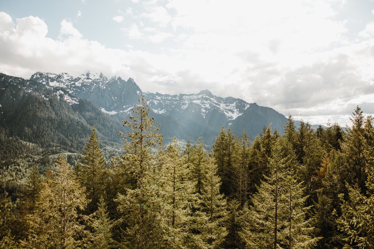
9 of the Best Hikes in Washington
I tried to Google “how many miles of trails are in Washington State?” to start this piece with a cool stat hook, but I couldn’t find a number. I did learn that there are at least 700 miles of trails in Washington State Parks alone, and with a whopping total of 19.8 million acres of public land in the State, I think it’s safe to say there are WAY too many to count, and we love that.
While I haven’t had the chance to set foot on every path, I have hiked quite a few Washington gems over the years, and thought I’d share with you what I believe to be some of best hikes in Washington, along with a few tips, tricks, and sustainable practices to make the most of your adventure. All of the hikes below are ones I’ve personally experienced and LOVE in order of length.
I hope you enjoy them as much as I do!
Table of Contents
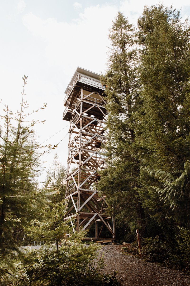
Heybrook Lookout
Distance: 2.6 miles
Type: Out and back
Difficulty: Moderate
Elevation gain: 850’
Location: Index, Washington
Native land: Coast Salish, Tulalip, Skykomish
Information gathered from WTA

Fire lookouts are vital pieces of PNW history. Every single one is unique with its own charm, and some even allow overnight stays! They’re super cool to see, and because they were actively used to spot forest fires (some are even still in service), and they often boast some epic views too. Bonus!!
Heybrook Lookout is accessible via a short trail off of Highway 2 near Index, Washington, and the lookout itself is one of a kind. Hike the 89 steps to the lookout’s viewing area. It’s worth it! It’s also one of the best hikes near Seattle too!

Ship Peak Loop: Turtleback Mountain
Distance: 2.7 miles
Type: Loop
Difficulty: Moderate
Elevation gain: 859’
Location: Orcas Island, Washington
Native land: Coast Salish, S’Klallam, Lummi, Samish, Semiahmoo, Tulalip
Information gathered from WTA
Up in Washington’s famed San Juan Islands lies a beautiful, and still relatively unknown hike to some killer panoramic views. The Ship Peak Trail begins on an old dirt service road, morphing into a more traditional trail at the top. Get ready to pick your jaw up off the floor because after the first mile, you’ll be hit hard with the insane views of San Juan Island, Shaw Island, Lopez Island, and all the way to your right, Canada. Yep, that’s Vancouver Island over there!
Whip out a snack and your peak beer, have a seat on the bench, and take it all in. Or, better yet, bring a hammock and chill for a minute. You’ll never want to leave.

Mt. Storm King
Distance: 4 miles
Type: Out and back
Difficulty: Hard
Elevation gain: 2,065’
Location: Lake Crescent, Port Angeles, Washington
Native land: Coast Salish, S’Klallam
Information gathered from WTA

There's no dull moment on this short yet steep trail to arguably one of the best views Washington has to offer. Hikers come from around the world to experience this epic Olympic Peninsula adventure for themselves and I totally see why! It starts as many of our Washington hikes do: in the trees. But don’t be fooled–at the fork, the trail immediately starts gaining elevation and never stops. Make sure you have lots of water!
The trail is maintained up until the last 0.7 miles to the top. From there, a series of ropes and some pretty sketchy terrain is between you and the iconic view. I personally like getting a little more technical–it takes my mind off the pain of the (elevation) gain, but don’t attempt this if you feel unsafe! Again, this part of the trail is not maintained, so you’ll be proceeding at your own risk.
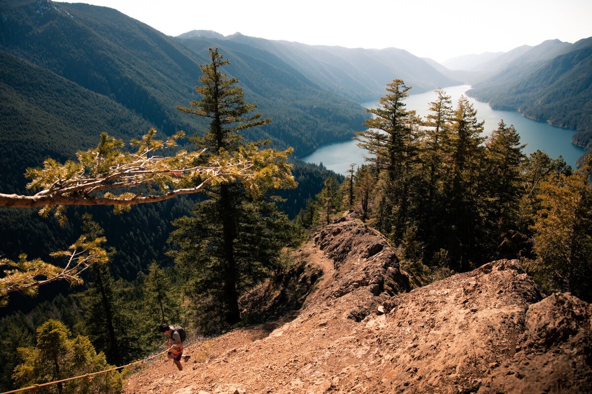
But my goodness… the views are just… there’s no words. Pack lots of water, take tons of breaks, eat all the snacks, and crawl up this hike if you have to. It’s worth it.


Hole in the Wall
Distance: 4 miles
Type: Out and back
Difficulty: Easy
Elevation gain: 0’
Location: Rialto Beach, Washington
Native land: Quileute
Information gathered from WTA
Washington's Hole-in-the-Wall is an easy 4-mile round-trip beach hike filled with sea stacks, marine life, driftwood, surfers, and campsites. It exudes ultimate moody vibes for the perfect PNW adventure year round!
It starts from Rialto Beach’s parking lot and ventures north–there’s no marked trail because it’s all super casual beach walking! That said, you’ll still want a pair of durable shoes for the sharp rocks and tide pooling you’ll be doing at the other end. Those barnacles and muscles aren’t too kind on the feet.

You’ll start seeing campers pitching their tents in the beach grass by the trees as you get closer to the first big seastacks visible from the parking lot. The famed hole is in the big, rocky bluff at the other end of the beach, carved by the power of the waves, which also means that it’s only accessible at low tide. Plan accordingly!
And remember: avoid walking on muscles and other sea life. Touching tide pool creatures is allowed, but use your discretion. In other words, treat others how you’d want to be treated ;)
Note: Permits are required to camp on this Olympic National Park beach. You can pick one up from the ranger station in Port Angeles.
Want to learn more about Washington’s Hole in the Wall? Check out my ultimate guide, linked here!

Blue Lake
Distance: 4.4 miles
Type: Out and back
Difficulty: Moderate
Elevation gain: 1,050’
Native land: Nlaka’pamux, Okanagan, Methow
Information gathered from WTA
I stumbled upon Blue Lake one year as part of my larch march, which refers to the two-week period in fall when a specific type of pine tree’s needles turn a beautiful golden yellow. It turned out to be an epic minimal effort, massive reward trip, and larch season or not, this Washington hike is one for the adventure books!
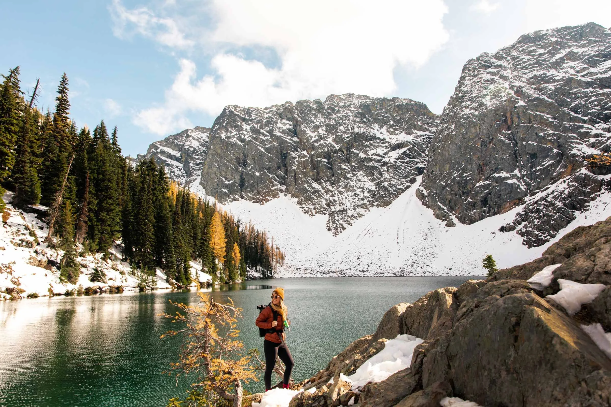
The first part takes you across boardwalks through gorgeous old growth forest before opening up to a beautiful meadow (keep an eye out for wildflowers) with epic views of Winter Spires and the iconic Liberty Bell mountain. Then, you’ll hike below the peaks, through more forest, and over a stream. You’ll see a cool old falling down log cabin, and to the left, a beautiful blue alpine lake–I wonder where it got its name? It’s the perfect lunch spot, lemme tell ya!


Heliotrope Ridge
Distance: 5.5 miles
Type: Out and back
Difficulty: Moderate-Hard
Elevation gain: 1,400’
Native Land: Coast Salish
Information gathered from WTA
A true gem, Heliotrope Ridge is a super fun and scenic trail with three river crossings (at various depths and ferocity depending on season–check the trail reports before going!) and varied terrain that ends at the super impressive Coleman Glacier. If you get lucky with a cloudless day, Mt. Baker is so close you can practically touch it! Head down to Harrison Camp, or stick to Glacier View for, you guessed it, glacial views. Original.
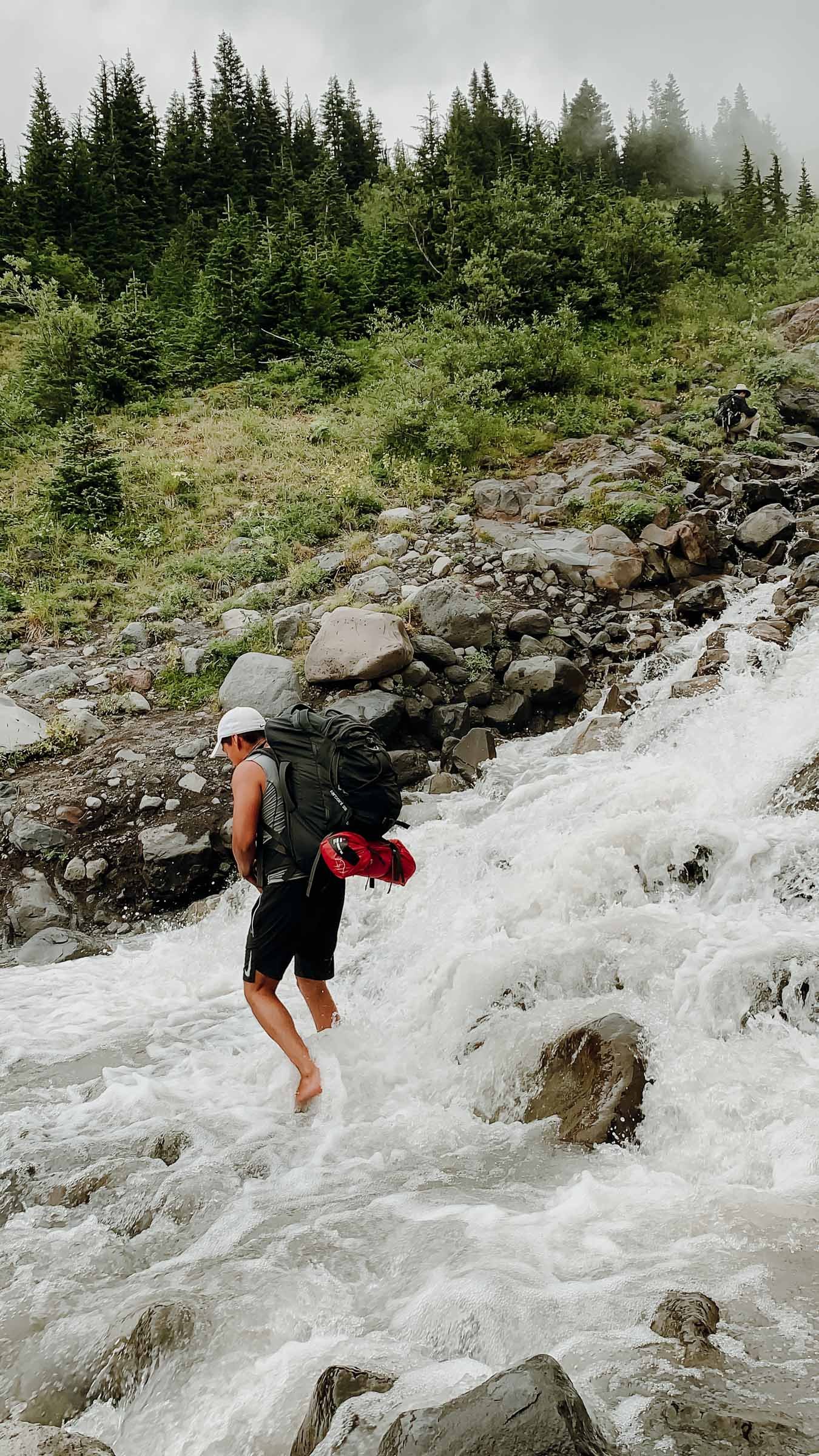
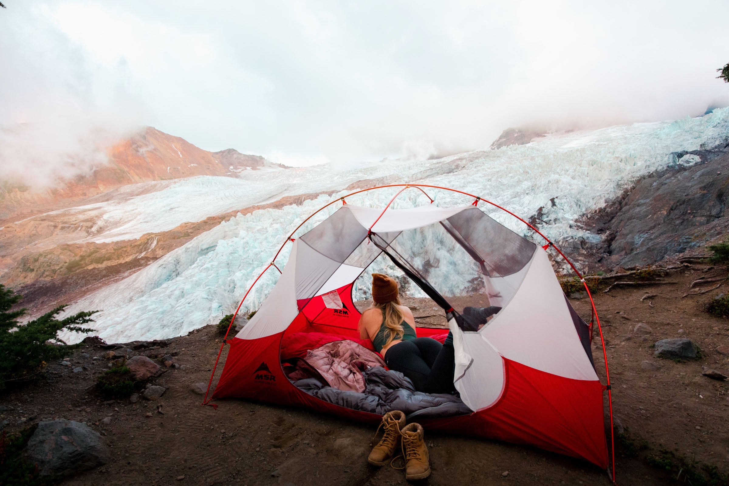
Harrison Camp is a popular basecamp for Mt. Baker summitters, so don’t be surprised if you see some skilled climbers crossing the crevasses down below.
Note: Do not climb on the glacier unless you’ve had the proper training. This is extremely important!!
Pro tip: Plan for late April for wildflowers and bring your tent for a short backpacking trip, perfect for first timers!

Fremont Fire Lookout
Distance: 5.6 miles
Type: Out and back
Difficulty: Moderate
Elevation gain: 1,200’
Native land: Puyallup
Information gathered from WTA
Whoever was stationed at this two-story fire lookout back in the 1930s won the lottery, that’s for sure. The 2.8 miles to the lookout teeters along the tree line, and if it’s clear, Mt. Rainier is with you every step of the way. It’s unreal.

Keep an eye out for mountain goats–there’s a heard that frequents this area!
Pro tip: Plan to be at the lookout for sunrise for an epic start to the day!

Lake Ingalls
Distance: 9 miles
Type: Out and back
Difficulty: Hard
Elevation gain: 2,500’
Native land: Yakama, Wenatchi
Information gathered from WTA

The best pee I’ve had yet!
Lake Ingalls is a Washington favorite, and for good reason. The trail passes through multiple ecosystems, starting in the trees, venturing through meadows, and ending above the tree line at a gorgeous blue lake surrounded by towering peaks. Yes, please!
After you tackle a few switchbacks and a large portion of the total elevation gain, you’ll arrive at Ingalls Pass where you’re faced with a tough decision: you can go right, which is the more direct and rugged route, or left for a longer but more relaxing stroll with campsites (and a privvy with the best view I’ve ever seen. Honestly, I’d go left at the fork just to use this thing. It’s epic.).
Better yet, do the loop! Why not, right?

I did this beaut of a hike in a day, but it’s also an awesome beginner backpack if you’d like to spend a little more time experiencing everything this wilderness has to offer. It’s also one of the State’s go-to hikes to spot larches–remember those deciduous pine trees I was talking about? Check out the photos to see what I mean.
Mt. St. Helens Summit
Distance: 10 miles
Type: Out and back
Difficulty: Hard
Elevation gain: 4,500’
Native land: Cowlitz, Klickitat
Information gathered from WTA
If summitting an active volcano is on your must-list, Mt. St. Helens is an awesome first. It’s tough, but requires no technical climbing skills in the summer, and at 10 miles round-trip, it’s nearly always done in a day! The only clincher: You’ll need to plan ahead to snag a permit, but if your dates are flexible, your odds are good!

Hikers start on the Ptarmigan Trail pre-sunrise, weaving through beautiful second-growth forest and meadows. Don’t forget to turn around–breaks in the trees reveal gorgeous views of the surrounding foothills! The permit zone starts as the trees end. We cleared the tree line to find ourselves above an inversion–how the heck did we get so freaking lucky–as the sun rose over Mt. Adams to the east. How the heck did we get so freaking lucky?!
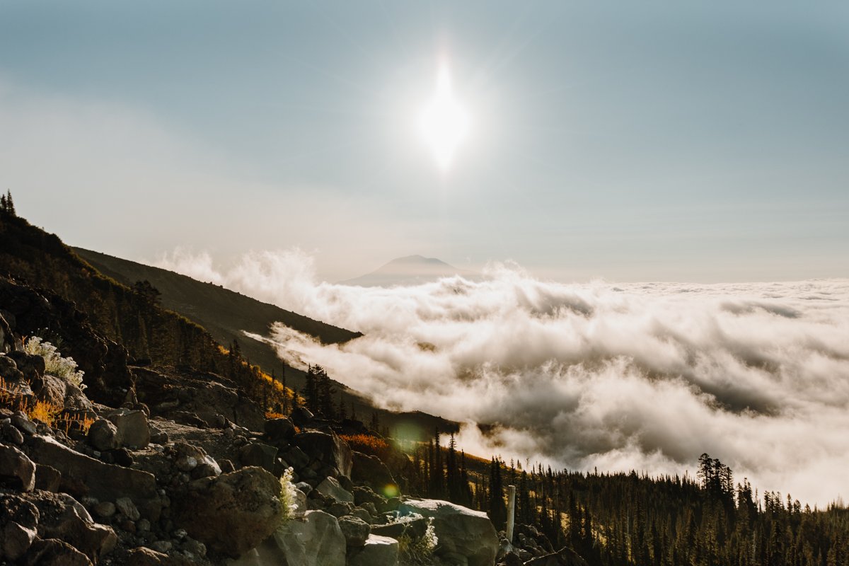
For those who are unfamiliar, an inversion is when the normal distribution of air–hot at the top, cold at the bottom–gets flipped upside down, or inverted, creating a cold layer of clouds at ground level, and warm air (clear skies) above.

The trail gets more challenging from here–hikers need to follow tall wooden posts wedged into the large pieces of pumice that make up a massive boulder field. If you have gloves, bring ‘em. You’ll be climbing hand over foot in some areas, and pumice hurts, lemme tell ya.
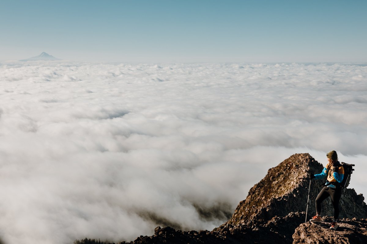
The last section is a 1,000 vertical-foot climb through ash–think walking uphill in sand–which is why it’s often deemed the most mentally challenging part of the hike. It really is like you’re taking one step back for every two steps forward, but it’s allll worth it once you reach the rim of the crater, look down to see the steam rising from the active volcano, and around at Mount Adams, Mount Hood, and Mount Rainier.


The sense of accomplishment is unmatched, and your snacks taste 100000x better up here, trust me.
now, Get After It!
What are you waiting for? Washington’s great outdoors awaits!
Always remember to leave no trace–pack out what you pack in, leave what you find, prepare for every adventure, and respect the outdoors and each other every step of the way. Learn more about how to leave no trace here.
And if you do decide to venture out on any of these adventures, drop a comment below or shoot me an email to tell me how it went!
Happy adventuring!
