The Ultimate Guide to Backpacking the High Divide Loop (Seven Lakes Basin Trail) in Washington
The High Divide Loop (also known as the Seven Lakes Basin Trail) is one of Washington’s most popular backpacking trails for a reason. It takes you through four ecosystems–old-growth forest, subalpine meadow, subalpine lake basin, and montane forest–and because it’s a loop, you’re hiking into new scenery around every trail bend, making it a truly diverse and freaking mind-boggling 18.3 miles.
If you’ve been contemplating hiking the High Divide Loop, let this be your sign. Do it.

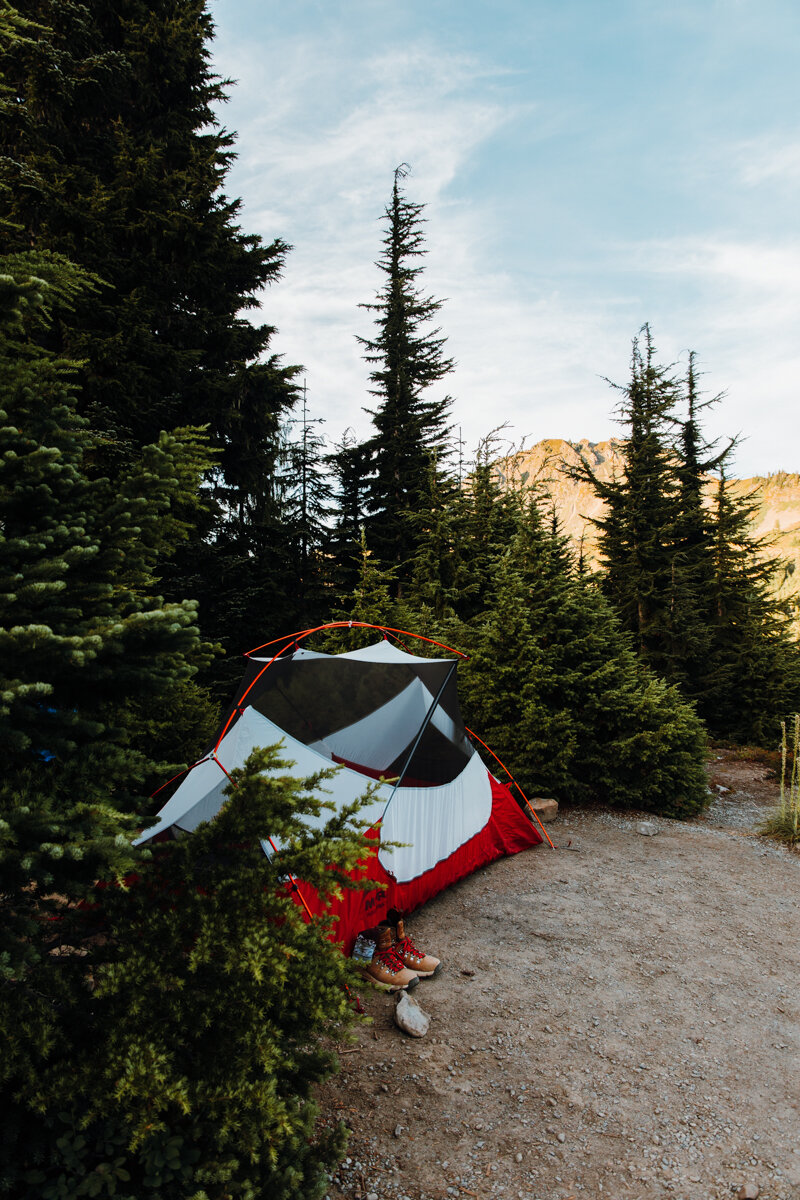
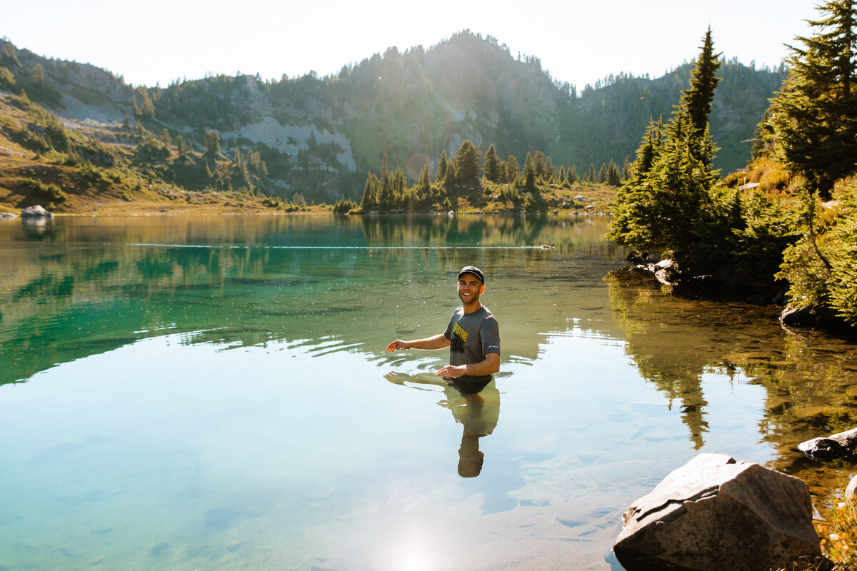
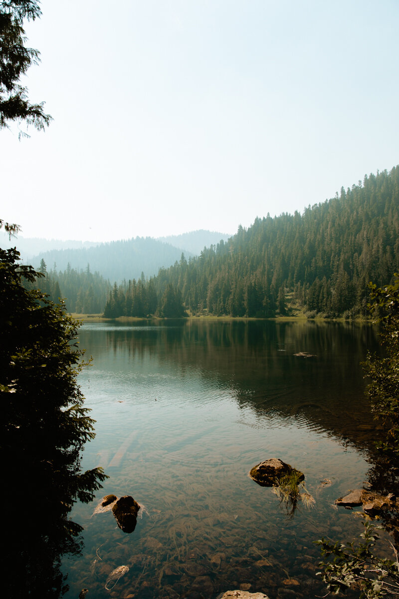
Lunch Lake on the High Divide Loop
Table of Contents
High Divide (Seven Lakes Basin) Loop Overview
Information from nps.gov.
Distance: 18.2 miles
Elevation: 3,050 feet gained
Difficulty: Moderate
Pass: America the Beautiful ($80 annual interagency pass) or Olympic National Park Pass
Permits: Required
Best time to go: Mid-July through October
General elevation trend: Moderate to steep
Native land: Coast Salish

Preparing for the Adventure
Like any backpacking trip, proper prep is key to a successful adventure. From gauging the elevation and distance according to your level of physical ability to careful packing and obtaining your permit, there’s a lot that goes into a backpacking trip before your feet even hit the trail, but let me tell ya, the views are WELL worth it.

Hiking the High Divide Loop with Mt. Olympus in the Background.
Planning Your Route
Plan your route out ahead of time so you know exactly what campsites you’re going for when it’s time to secure your permits.
Hikers can do this trail in one-to-three nights. We chose to book three nights (Heart Lake, Lunch Lake, and Deer Lake), but wildfires smoked us out on the third day, turning the three-nighter into a two-nighter, which felt doable to me!
Pro Tip: Try to keep a good distance between each campsite. These distances will vary depending on how many nights you plan to spend on the trail.
Campgrounds
Here’s a list of all reservable campground/campsites on the High Divide Loop listed in clockwise order. I’ll go into detail about each reservable campground later in the article.
The hike’s most sought after sites are Heart Lake and Lunch Lake. We camped at the sites in bold.
Sol Duc #1
Sol Duc #2
Sol Duc #3
Sol Duc #4
Appleton Junction
Seven Mile Group Site
Rocky Creek
Sol Duc Crossing
Lower Bridge Creek (No Campfires)
Sol Duc Park Group Site (No Campfires)
Sol Duc Park (No Campfires)
Heart Lake (No Campfires)
Lunch Lake (No Campfires)
Deer Lake Group Site (No Campfires)
Deer Lake (No Campfires)
Canyon Creek #3
Canyon Creek #2
Canyon Creek #1
Sol Duc Falls
Mink Lake

Our Lunch Lake campsite on the High Divide Loop had killer views!
Getting your permit
Permits are required to backpack in Olympic National Park.
Why do we have to obtain a permit? Monitoring the number of visitors to a certain area maintains a balanced ecosystem and preserves the beauty for all future visitors. It’s also a safety precaution so park rangers know who’s in the backcountry at any given time in case the unthinkable happens.
There’s a new permit system in place as of 2023. All Olympic National Park permits for the entire summer (May 15th through October 15th) will be released at 7 a.m. PST on April 15. Mark your calendars, and be ready bright and early to reserve your dates when they go live!
Make a Recreaton.gov account.
Search for Olympic National Park Wilderness Permit.
Click “Check Availability".”
Make sure the dropdown menu at the top reads “People” and select how many people will be joining you on the hike. You can reserve for up to 12 people. It costs $6 to reserve and $8/night per backpacker.
Then select your starting area. This hike’s starting area is “Sol Duc.”
Select your desired campsites and click “Book Now.”
Once payment has been made, you’ve successfully secured your permits and are officially a future High Divide backpacker!! Woohoo!!
Displaying Your Permit
You must print your permit or pick it up from a ranger station (I’d recommend the Olympic National Park Visitor Center) before heading out on your trip and have it accessible in case a park ranger asks for it along the way. Some backpackers choose to put it in a ziplock bag and attach it to their tents to make it easier on the rangers, but as long as you have it on your person, you’re golden.
Scroll to the bottom for a detailed and downloadable packing list!
Getting There
About 15 miles south of Lake Crescent on Washington’s Olympic Peninsula, turn onto Sol Duc Hot Springs Rd. and enter the park through the Eagle Creek Ranger Station. Continue down the road until it dead ends at the Sol Duc Trailhead.
Put your national park pass in your window, gear up and get going! It’s time hit one of Washington’s most celebrated trails. Let’s get it.
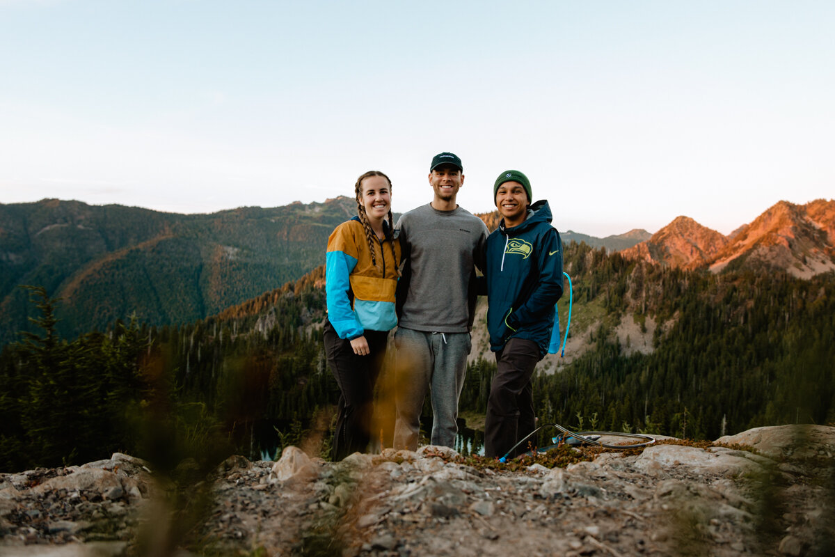
Backpacking the High Divide Loop
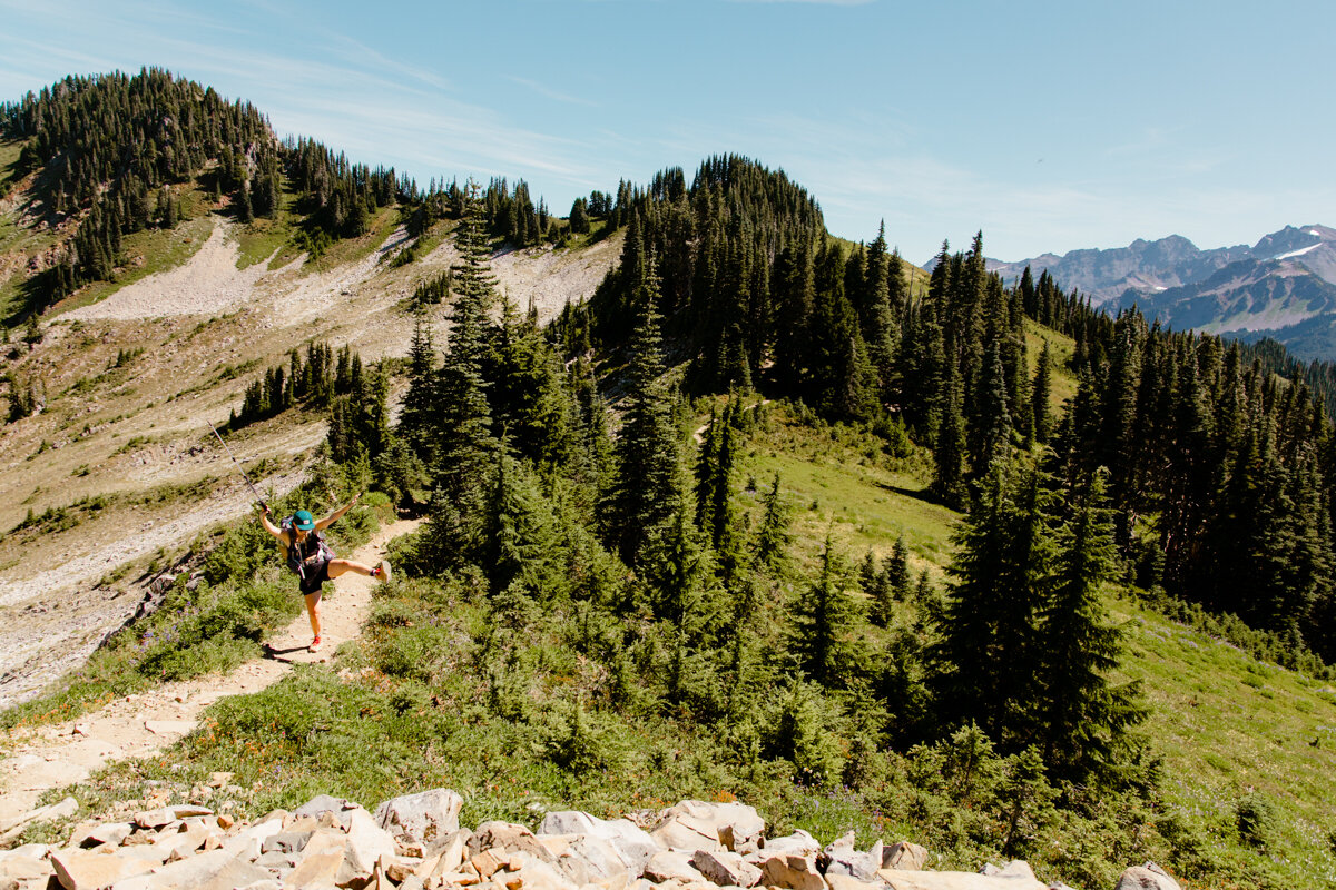
The First Steps + clockwise or counterclockwise?

Woohoo!! Pack is on, the first steps of the trail are under your hip belt, and the promise of epic adventure lies just around the bend. We’re feeling great. The good news is, because you have permits, you already know exactly where you’ll be camping tonight and the next, and if you chose to do a third night, that too. You know exactly how many miles until your first site, and showed up at the trailhead with plenty of time before dark.
Because it’s a loop, there’s one of two ways you could go: clockwise or counterclockwise. So, which do you choose? If you already have your permits, the direction is decided for you. If not, consider the trail’s elevation and terrain and make a decision based on your body’s physical abilities. There’s a steep and rocky 2-mile section just past Sol Duc Falls to the right that I’d say is the deciding factor when it comes to hiking direction.
Ask yourself this: Does your body prefer climbing steep grade or hiking down it? If you have sensitive knees, I recommend climbing it, which means you’ll want to do your trip counterclockwise. We chose to go clockwise, leaving that last steep leg for the end. We relied heavily on our poles for support and the next day, a muscle I didn’t even know I had was sore from 7.2 miles and nearly 4,000’ of downhill hiking in one day. There were moments I wished I’d climbed that portion instead.
Something to consider!
Leg 1: Parking Lot to Heart Lake
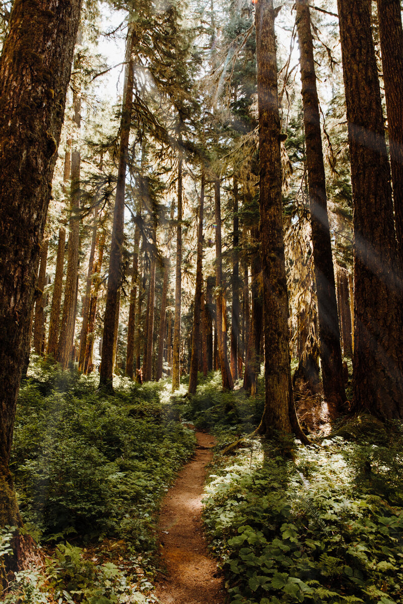
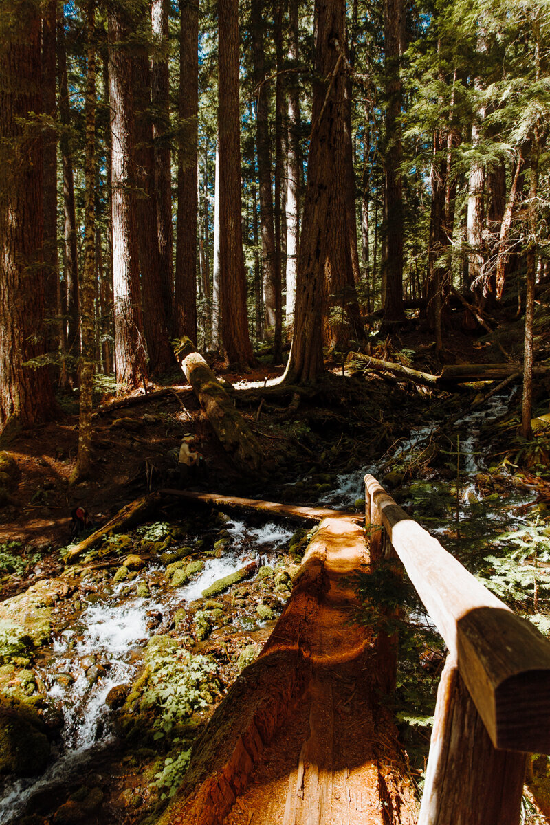
We veered left for a clockwise route and headed upriver through old growth forest, over some of the coolest wooden bridges (one was literally a fallen tree with a trail etched into its trunk from foot traffic), and among huckleberries, which became a tasty trail snack just as soon as we verified they were safe to eat. Today’s final destination? Heart Lake, which is about 10 miles from the parking lot.
Huckleberries look just like blueberries on the outside, but have a deep purple juice when squeezed. This trail also features coastal huckleberries, which are an orange color. Don’t get them confused with their poisonous counterparts. We stayed away from those just to be safe–wouldn’t that be a great way to start off a backpacking trip?

After about 3.5 miles, you’ll see the first of four Sol Duc River Campsites. They’re all decently spacious and close to the river, which means unlimited running water for all your water needs. We stopped for a quick trail snack before continuing on.
If you want to have a campfire during your trip, this is the place! Campfires are not permitted above 3,500’ in Olympic National Park to preserve the park’s fragile alpine vegetation. Get it in while ya can!
Veer right at Appleton Junction (there’s another campsite here) to continue on the High Divide trail. You’ll pass a group campsite (Seven Mile) before crossing the Sol Duc River over another falls. Take a minute, soak it in, grab a snack, and relax at the Sol Duc Crossing campsite on the other side if it’s still vacant. You’re about to begin the climb.
It picks up pretty fast from here with a 30% grade at one point but nothing you can’t handle! Just take it slow, stop to admire the wildflowers, and don’t forget to drink water (LOTS of it).
The trail levels out for a minute in a gorgeous subalpine meadow (say hello to ecosystem number two!). Peaks being to emerge between the trees on all sides. It’s glorious.

About six miles in, you’ll reach Sol Duc Park Campground. On one side, the Sol Duc River made the perfect swimming area to cool down after a long day in the hot sun (I was so tempted to dive in!), and on the other, another glorious subalpine meadow. Butterflies landed on the cow parsnips that lined the trail–freaking magical.
I wanted to check out the lone campsite that jutted out far to the left, but we kept on keeping on–we wanted to make it to Heart Lake with plenty of swimming time.
Just past Sol Duc Park, the trees began to thin and the valley opened up. We were officially in Heart Lake Basin, and WOW was it stunning. Tons of little streams trickled down through greenery and wildflowers and a small waterfall signals your last 1/4-mile before Heart Lake. If Bambi frolicked through the grass, the scene would be complete.
Take your time here. Walk slow. Enjoy it. The rest of the hike is incredible, but in a very different alpine-y way. This place is truly something special!
And finally, up a few stairs, Heart Lake comes into view, and it’s totally named appropriately. We snagged a campsite protected by trees on the southeast side of the campground (Site #1), set up camp, and practically ran to the lake to jump in.

Be careful to walk only on designated trails to not trample the meadow or any cute little frogs that might be hanging out by the lake or streams.
We found a nice, durable rocky area in the heart’s crevice, laid down our microfiber towels as interim camp for our afternoon swim sesh. It felt AMAZING after a long 10-mile and 80-degree day.


We did see a ton of tiny little red floating things in the lake. After looking closer, they were alive, swimming around, and I went to a dark place, thinking about how many of those little creatures were trapped in my hair, clothes, and yep, vagina. I pushed it out of my mind and spent a little less time in the water that day.
After a little research, I’m pretty sure they were red water mites. Nothing to worry about! Still didn’t love it.
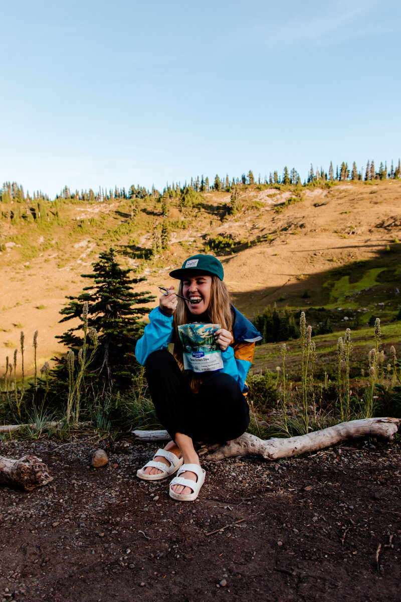
We ended the day with Backbacker’s Pantry’s Three Sister’s Stew, M&M’s, and a little reading.
Then, the wind kicked in. It was wild, how one second it was calm enough to see the mountain’s reflection in the lake, and the next, wind was gusting through the trees at full speed. Stake down your tents, people!
Pro Tip:
If you’re like me and think way too much about something as small as a twig snapping, bring ear plugs! You’ll want to be well-rested to keep that energy up when you’re out on a multi-day hike.
Privies
Vault toilets, or “privies” are placed at each group campsite, Sol Duc Park, Heart Lake, Lunch Lake, and Deer Lake. Each privy has a small container designated for poop and toilet paper only (they’d fill up way too fast if we all peed in them too). When you have to pee, find a rock or hard surface at least 200’ from a water source or campsite.
Peeing on hard surfaces keeps animals from tearing up plants to get at the salt in your urine.

Sunset at Heart Lake
Leg 2: Heart Lake to Lunch lake
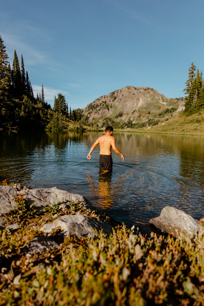
5:45 a.m. comes all too soon. Sunrise in the backcountry is hard to beat. For just a moment, everything’s calm. The bugs are sleeping and the sun slowly starts to peek over the horizon, coloring the Olympic mountain range a bright orange. It’s typically the perfect time to capture pro-level lake reflection photos. Typically. It was still pretty breezy this morning, so our captures from the night before will just have to do!
I am SO not a morning person, so I went back to the tent for a 2-hour nap before deciding it’s coffee time. I stirred up a Starbucks Instant Vanilla Latte, poured some hot water into my Kodiak Oats (12g of protein in every packet! Can you believe it?), and enjoyed it with a view.
We took it easy, knowing this portion of the hike was only about 4 miles. That said, we still wanted to head out relatively early to have ample time at our next destination: Lunch Lake.
By the time we filtered and refilled our water reservoirs at Heart Lake, it was 10 a.m. and we were amped because it’s High Divide day!! It’s the day we got to experience what people come from all over the world to see. Who wouldn’t be stoked about that?

PRO TIP:
There is NO water between Heart Lake and Lunch Lake (if you’re hiking early in the summer, there may be snow that you could use for water, but by the time we got there, they were completely melted), so make sure you fill up ALL of your water reservoirs before hitting the trail. Between some elevation gain, no shade, and hot Washington summer heat, you’re going to need it!
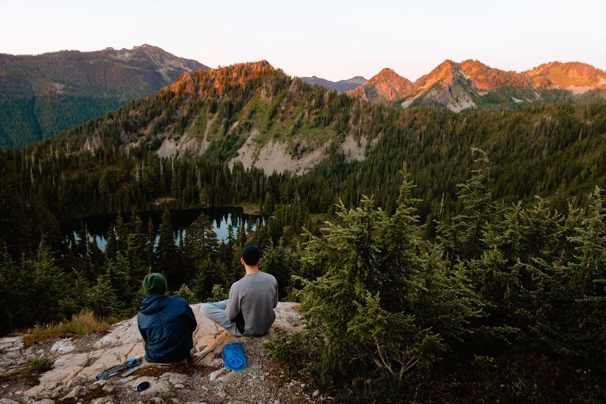
The next four miles were unbelievable. To the right, the Seven Lakes Basin in all its glory. To the left, none other than the famed Mt. Olympus and the Olympic Range, glaciers clear as day. We took it slow, stopping to snack at the best views, taking way too many pictures, and getting a little burnt because we were so caught up in the views that we forgot to reapply sunscreen. Oops.

Mt. Olympus from the High Divide Loop
Again, take your time. Walk the little viewpoint trails (only the ones that are open. There are plenty of trails marked as closed for restoration–please follow all signage) and snack often. Don’t forget to drink that water too!

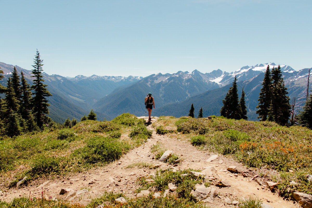
If you have the energy, take the trail up to summit Bogachiel Peak! (Yeah, I know, I didn’t know how to say it either. In fact, I straight up butchered it, so you know me, I went home an dlooked it up. It’s pronounced “bo qwa tcheel el”,” or /boqʷač'íʔl/, from /bó:q'ʷa/, "muddy", and /číʔlowa/, "water", meaning "gets riley [turbid] after a rain", "muddy waters.” To be totally honest, I still can’t say it, but you’ll be able to see a tiny sliver of the Bogachiel (Bogey) River in the valley to the southwest below! That big one you see to the south, though? That’s the Hoh!
You’ll gain a little less than 100’ on your climb and get to see two valleys: the Seven Lakes Basin to the right and the Bogachiel River to the left, where we found a herd of elk lounging in the valley.
The path down the other side was closed, so we continued down the loop trail on the west side of the ridge and met up with the High Divide Trail just before the fork. It was a little sketch. Use those poles and watch your step!

View from one side of Bogachiel Peak.
You’ll want to veer right to continue on to Lunch Lake. Left will take you to the Hoh Lake, which I hear is also super gorgeous!
Just past the fork, a bear came into view minding its own business in the valley below. We walked together with a couple hundred feet between us over a boulder field before it disappeared into the trees.
Bear Safety
If you run into a black bear on the trail, don’t freak out! Instead, make a lot of noise, stand your ground, and be as big as you can. Raise your arms, spread your legs, and talk to it loudly so it knows you’re there. We don’t want to surprise them.
That said, always make sure your bear spray is easily accessible just in case!
Watch this how-to video to learn how to use bear spray safely and effectively.
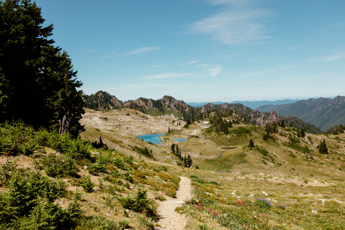
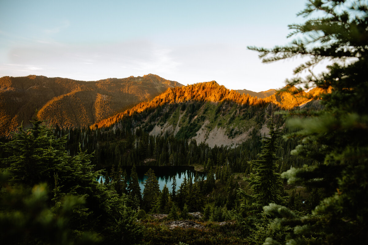
Lunch Lake
To access Lunch Lake, you’ll need to veer off the main trail and descend over 500’ into the Seven Lakes Basin. The trail is rocky with stone steps, requiring some attention when it comes to foot placement, which was so freaking hard when a gorgeous blue gatorade lake was taunting me with its cold, refreshing water the entire time. I basically fell down the side of the mountain. I don’t know what it was about the last little hill that was my last mental straw but I was over it, more than ready to throw down my pack and cool off in the water.
Finally down, it was time to snag our campsite.
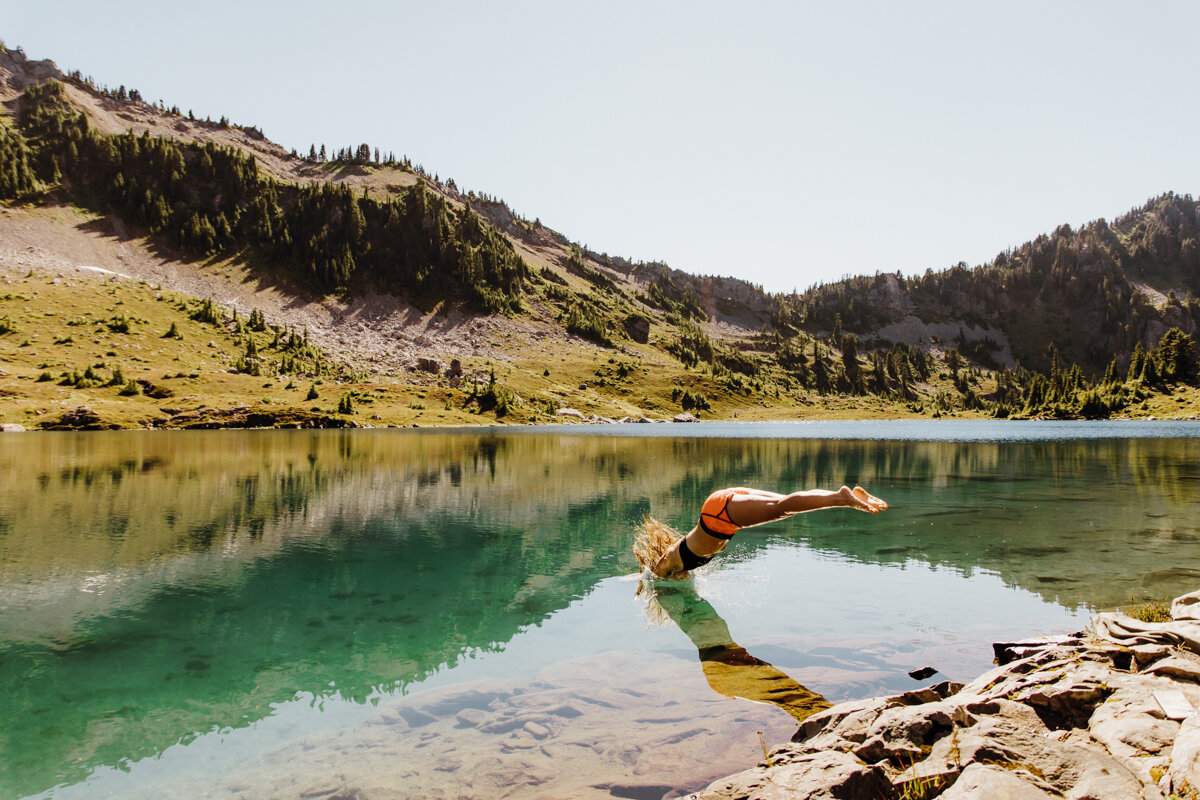
Swimming in Lunch Lake.

Like Heart Lake, Lunch Lake’s reservations aren’t numbered, so you get to choose your actual site day-of even though you already have a permit.
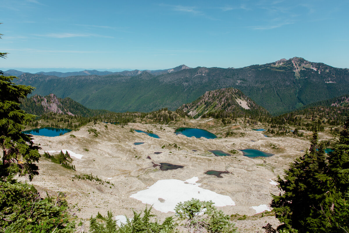
There are three lakes you can camp at: Round Lake, Lunch Lake, or Clear Lake.
Round Lake looked a little green and shallow and required a little more elevation loss to get to its shore.
Clear Lake is past Lunch Lake requires an even bigger elevation loss, so that was out.
Regardless, Lunch Lake was easily the most stunning of the three, with it’s glorious water and sky-piercing peaks. I knew where I wanted to be.
There are plenty of awesome campsites, you can’t go wrong, but if you want spacious privacy, epic mountain views, and close access to the privy, I recommend #11, which is the one we snagged for the night.

If you’re feeling active, hike the trail over to the other lakes in the Basin. I low key regret not doing so. Even though it was a shorter day, I was exhausted with a chest cold coming in hot. I stayed by the water instead.

Wasn’t lying to you about the lasagna… that face says it all.
Highly, highly, highly recommend going for a swim here. It’s cold, but refreshing, and made me feel like an entirely new human being! Clean and ready for a cozy night under the stars.
We played some cards, dined on Backpacker’s Pantry Lasagna, brushed our teeth, and passed out.

Oh yeah, we slept without a rainfly the entire time! Skies were clear, the stars were next level, and we woke up dry (no dew here!).
Leg 3: Lunch Lake to Deer Lake (Or in this case, home)
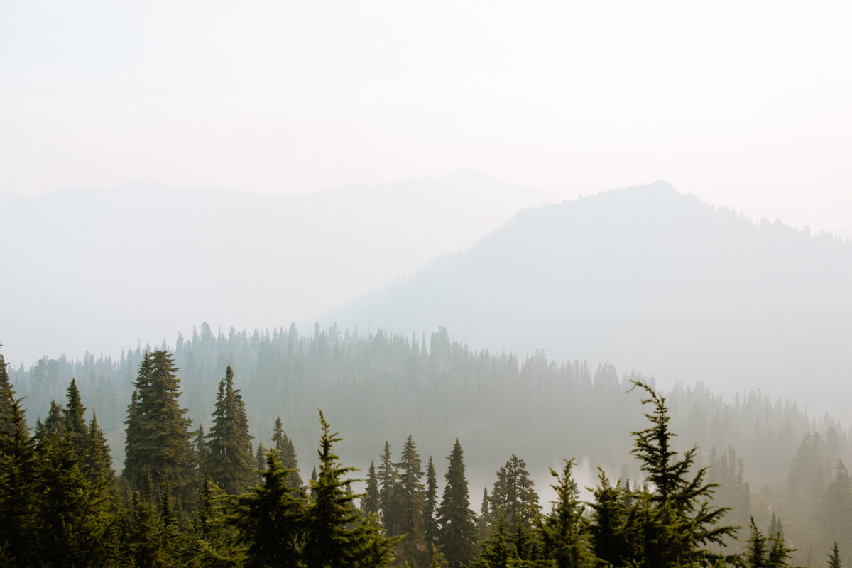
Another sunrise alarm, but this time, no sunrise. I woke up to a cloud of encroaching smoke and a yellow sun trying to pierce through the thick haze. The wind switched and Eastern Washington’s wildfire smoke was being blown in our direction and fast. Within 30 minutes, the entire basin was smothered in the stuff. We could barely make out the mountains right in front of us. Here’s a little before/after.
My chest cold got significantly worse overnight and even more so with all the smoke. We were supposed to camp at Deer Lake tonight. We decided we’d play it by ear. If the smoke was this bad at Deer Lake, we’ll hike the rest of the 3+ miles to the parking lot and head home. It’s not worth our health to stay an extra night in the backcountry.

So, we ate a big Breakfast Hash, drank our coffee, packed up, and got out of there. We were sitting in a bowl of setting smoke and crossed our fingers it would be better on the ridge.
It wasn’t.

500’ higher than 15 minutes before, a series of steep and rocky switchbacks behind us, and still, the smoke was everywhere.
Once back on the main trail, we crossed a small boulder field and started into the trees. These trees were very different from the first set down below. Higher altitude trees are more spindly–better suited for the harsher, colder environment of these high-elevation peaks.
The views looking west were probably stunning outside of all the smoke.
Eventually, more huckleberries provided more fresh snacks for the way down. We walked through subalpine meadows, past views where every once in a while, it looked like Canada’s mountains came into view before disappearing into the smoke.
We went down, down, and down, winding around small lakes and ponds until we eventually arrived at Deer Lake.
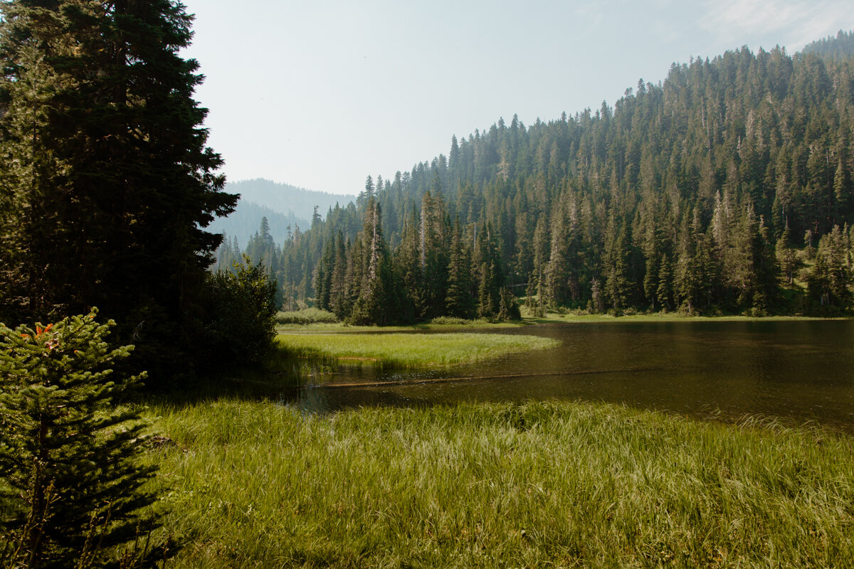
Much swampier than the rest, Deer Lake is surrounded by grass and every so once in a while, a fish would pop its head out of the water, probably trying to snatch a bug. If you like to fish, this lake is for you!
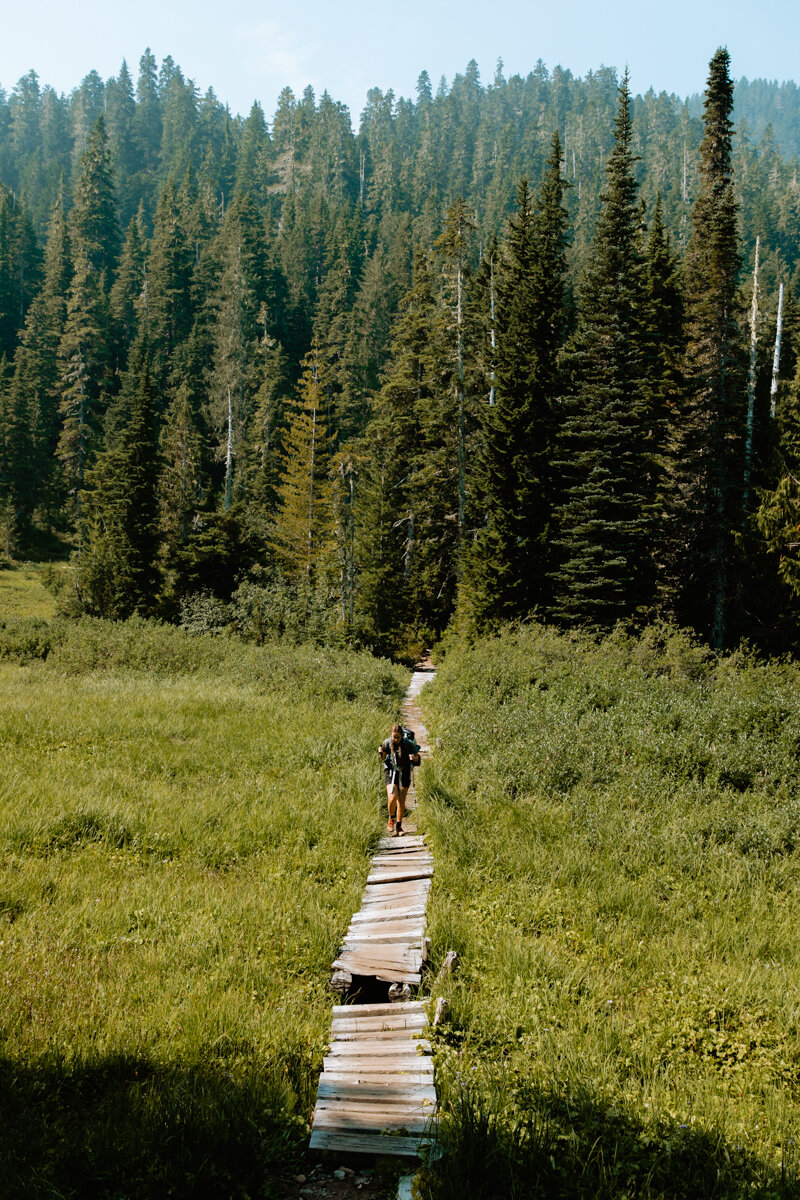
There are campsites on both sides of the lake, accessible via a super cool (and old) boardwalk. Watch your step!

Sol Duc Falls, Olympic National Park
The smoke stuck around, so we decided to hike the last 3+ miles to the parking lot and head home a day early. This last leg was steep, rocky, and felt longggggg. I don’t know if we were just ready to gtfo or what, but all of that downhill hiking with rocks pushing my ankles in every direction did NOT feel good. I literally took zero photos.
We passed Canyon Creek campground–each campsite was nestled beneath the trees with plenty of privacy. I want to say there was at least a half mile between Canyon Creek #1 and #2.
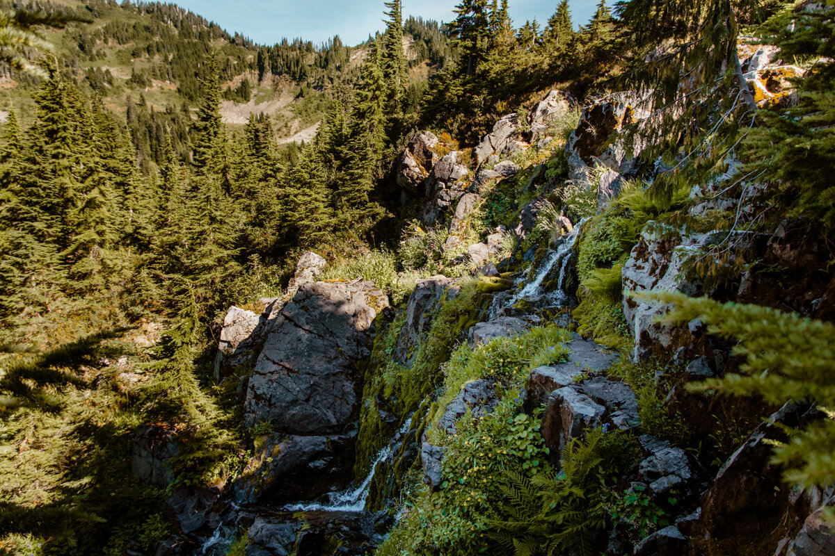
Another wood bridge came into view, with a waterfall below, and we dropped our packs for a quick breather. I downed the last of my energy chews, re-hydrated, and sucked it up for the last 1.4 miles to the parking lot.
We passed more and more day-hikers heading up to Deer Lake for the day, and finally, Sol Duc Falls came into view. The last landmark before the parking lot. The falls are pretty spectacular–they consist of three spouts that pour into an impressive fern-lined canyon below. I did manage to muster up the energy to snap a quick phone photo.
We made it back to the car, tore off our boots, and headed straight out to the Coffee Box to pick up an Acai Bowl. Highly recommend. Usually I crave a burger or something super greasy, but for some reason my body decided to continue with the healthy rigor and opt for Acai. Not sad about it.
Don’t forget to Leave No Trace of your stay! Here are a few quick tips:
Pack out everything you pack in
Don’t have fires above 3,500’. If you’re below 3,500’, build a fire in the designated fire pit and use only fallen wood.
Camp only in designated campsites. Look for flat, dirty areas surrounded by rocks or logs. This trail has very clear wood signs pointing to most of the campsites, so they should be easy to find!
Keep all food in your bear canister and don’t feed the wildlife.
When you gotta go:
Peeing: Find a hard surface 200’ away from campsites and water sources. Pack out any toilet paper.
Pooping: Use a privy if possible. If not, dig a hole 6-8” deep 200’ or more away from a campsite or water source. Pack out all toilet paper
Familiarize yourself with all seven Leave No Trace principles before hiking out.

Packing List
Sleeping System
Backpack
I got to use the Osprey Aura 50mL backpack for the very first time this trip and I’m HOOKED. The support is next level, and the back ventilation was clutch during these super hot days. It has two side pockets, a front open pocket where I kept my bear spray, and two zipper pockets on the hood. The only thing I wish this bag has that it doesn’t is side access, but I managed without it just fine.
Sleeping Bag
Marmot’s Women’s Ouray is water resistant and filled with 650 duck down, making it lightweight and warm down to 0 degrees.
Sleeping Pad
I use the Klymit Static V-Lite.
Tent
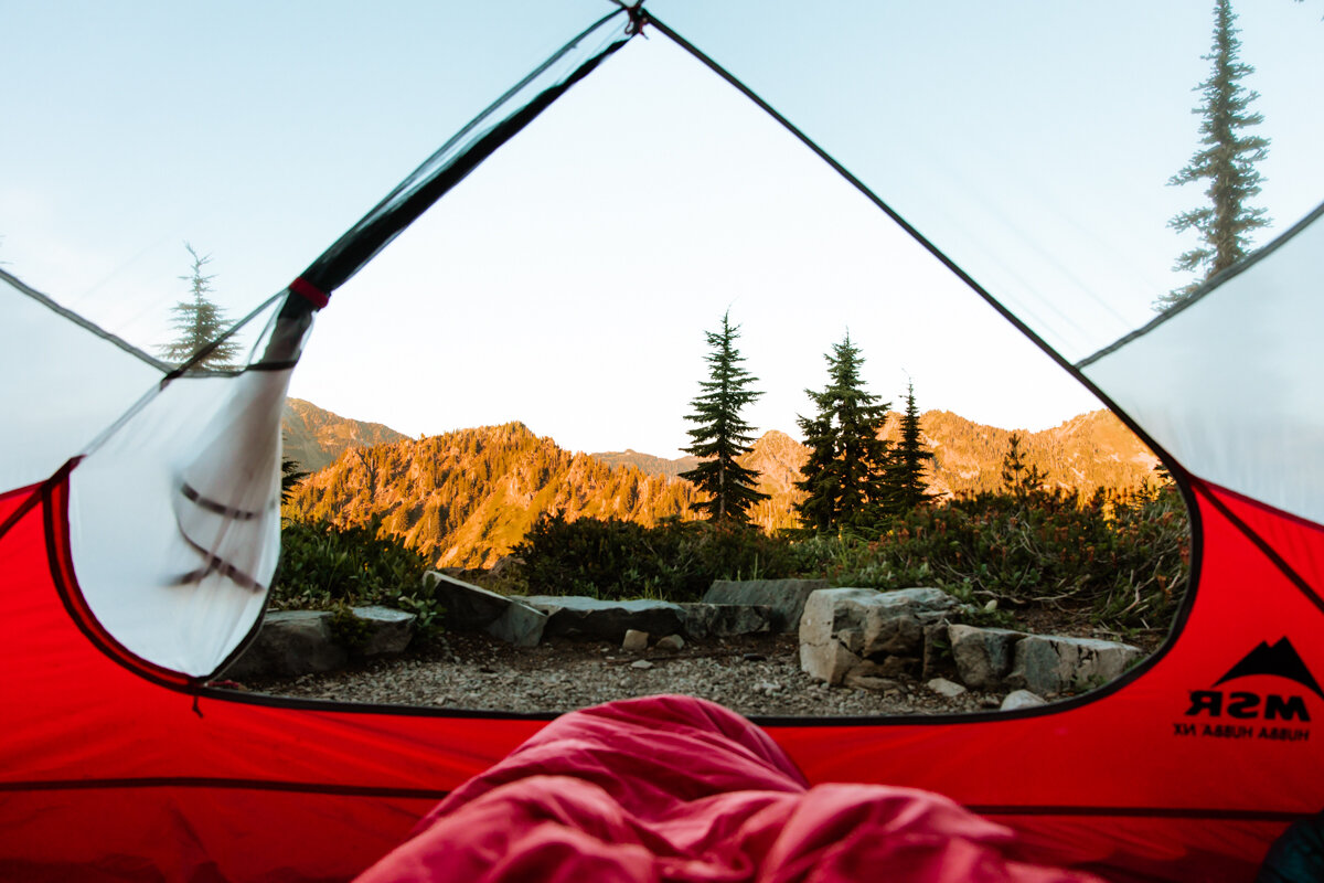
MSR Hubba Hubba NX Tent for lifeeeee.
Pillow (optional)
I’d rather save the space and weight for something else (like my coffee mug), so I scrunch up my puffer into a makeshift pillow or sleep without one all together.
Gear
This is how I kept my phone charged throughout the trip to capture videos.
Cards (optional)
Journal (optional)
If you’re looking for a way to record your hikes, check out my Dirtbag Diary, available on Amazon :)
Backcountry Kitchen
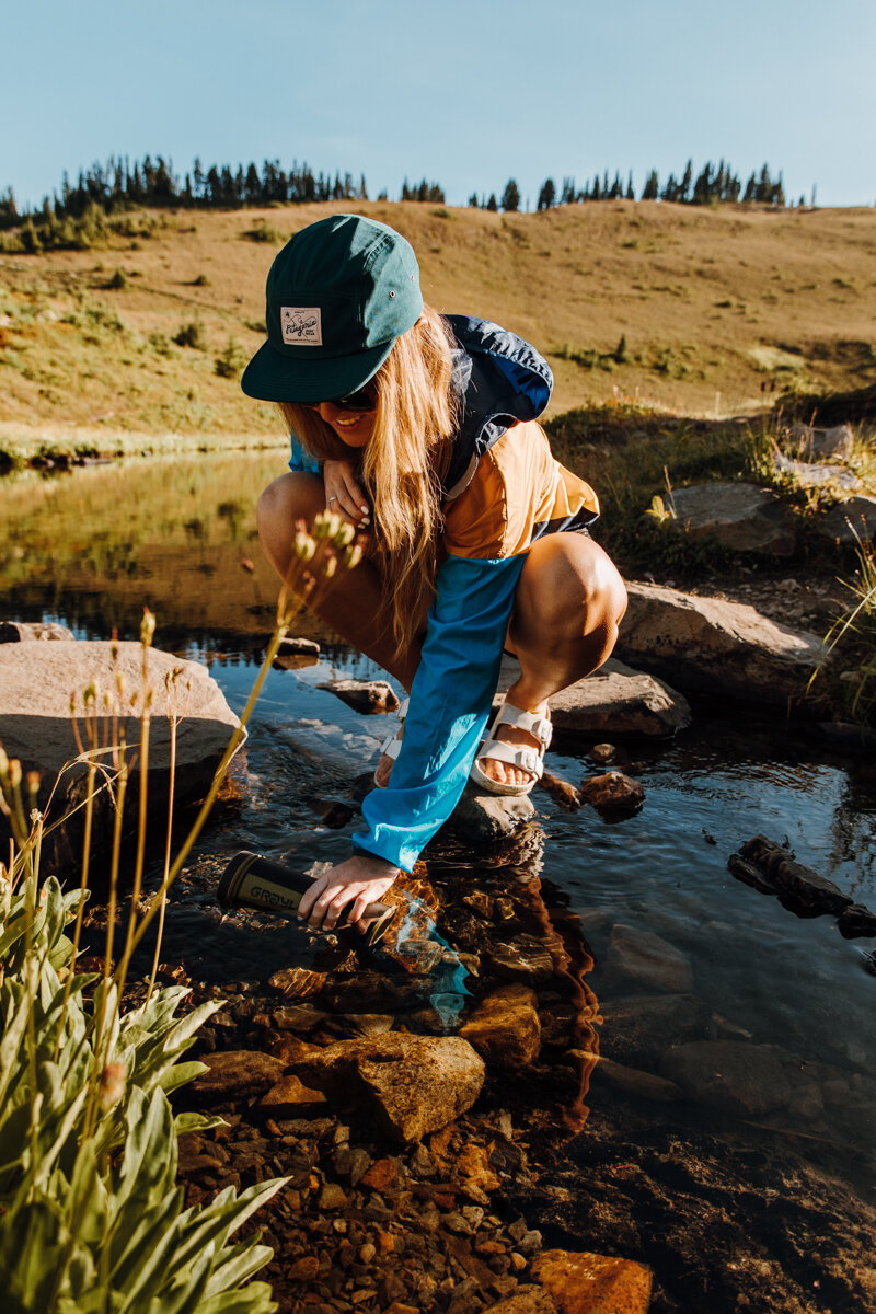
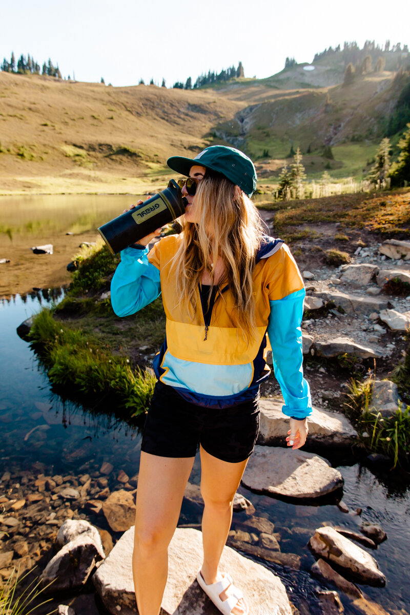
Water Filtration + Storage
I always bring my GRAYL and a water bladder. The GRAYL is a two-in-one filter and water bottle that I use to fill up my water bladder. When all is filled, I have 2.5L of filtered water. Luckily, this trail has plenty of water sources, so I could fill up at any time.
Food: Remember, all-day hiking means you’ll be burning a heck of a lot more calories than you might be used to. Pack high-protein and high-caloric foods to keep you going.
I love starting the day with Starbucks’ Instant Vanilla Latte and a Kodiak Oatmeal pack (which has 12g of protein each!). Pour water straight into the oatmeal packet and enjoy!
Snacks: Pepperoni sticks are where it’s at. I also bring a hefty bag of peanut M&Ms, some Cliff bars, dried mangoes, and Bolt energy chews. Bolt chews are organic, caffeinated with mate, and have Vitamins B & C.
Dinner: There’s nothing like ending the day with a hot meal. There are freeze dried meals of all types these days (I recommend the lasagna or anything that doesn’t involve a lot of spices).
Dessert: It’s the little things! Bring a little treat to look forward to after a long day. Sometimes I’ll save my M&Ms to have after dinner for a little dose of chocolate. The candy coating keeps them from melting!
MSR Pocket Rocket Mini Stove Set (that includes a pot)
Lighter
Waterproof Matches
These are required for everyone hiking the High Divide Loop. You’ll likely see a bear or two (or 12 according to one trip report) and they’ll get a little curious if there’s open food around. Keep it locked up both for your safety and the bears’ health!
You can pick up one for free from a ranger station or the Olympic National Park Visitor Center, but I ended up purchasing the BearVault after the COVID bear canister shortage.
Mug: For coffee, tea, or a meal. You can always drink out of your pot to save a couple of ounces, but a lightweight, insulated mug to keep my coffee hot is worth the weight to me.
Clothing
Head
Baseball Cap
The sun is no joke out there! More than half of your hike will offer little-to-no shade, so come prepared!
Beanie
It can get chilly at night and most of your heat escapes through your head. Pack a beanie to trap it.
Bug net. If you’re hiking earlier in the summer, definitely bring one of these along if you want to spend any time outside of your tent! The bugs are fierce.
Chapstick with SPF
Body
T-Shirt or Tank – Here’s the Amazon tank I wore the whole time!
Quick-Dry Sports Bra
Waterproof Windbreaker
I brought my Cotopaxi and used it mainly for mosquitos.
Insulating Layer (like a puffer)
It ended up being too hot to wear my REI puffer, so I used it as a pillow instead. Good to be prepared just in case!)
Quick-Dry Shorts
I prefer biker shorts to eliminate thigh chafing, but the ones I wore off Amazon weren’t as quick-dry as I’d like. I brought other running shorts to swim in.
Leggings with Pockets
I went during August when it was pretty hot, so I brought my Naked Feeling leggings from Amazon in case I needed an extra layer for either warmth or mosquito protection.
Hiking Pants (For at night and mosquitos)
Feet
Smartwool Socks
Yep, you bet I was rocking From the Ground Up Socks’ Olympic National Park socks the whole time.
Hiking shoes or boots
I LOVE my Danner Mountain 600s. I wear these on every.single.adventure, and they did me proud on this hike too! Ankle support is great for crossing boulder fields or streams and keep your toes from hitting the front of your boots when hiking downhill (which will be about half of your trek!)
Sandals
Once you’ve finished hiking for the day, you’ll want some waterproof open-toe sandals for around camp and by the lake. I use these rubber knock-off Birkenstocks from Amazon–I can wear socks with them, and they can get wet!
Health + Hygiene
Toothbrush + Toothpaste
We packed enough zero-waste Bite toothpaste tablets for each day–they’re dry, small, portable, and precise, which make them great for backpacking!
Menstrual Cup if it’s that time of the month
Toilet Paper or Wet Wipes
Stall Mates are compostable multi-use wet wipes. Use them for a hippie shower or to wipe your booty. But just because they’re compostable doesn’t mean you should bury them! Pack them out with you if you’re digging a poop hole, or leave them in the privies at designated High Divide campgrounds.
Other Items
Duct Tape
Paracord
Bug Spray
We heard how bad the bugs were up there and tried Sawyer’s military-grade bug spray for your clothes. This combined with Sawyer’s bug spray lotion led to only four bites after three days, so I’d say it was a success!
Side note: Loved the lotion bug spray option. I usually spray it into my hands and rub it onto my body anyway, so have a lotion made it super quick and easy! It just makes sense. Make sure to rinse your hands before snacking though… it doesn’t taste good and it’s so not good for you.
Whistle
Permits
ID